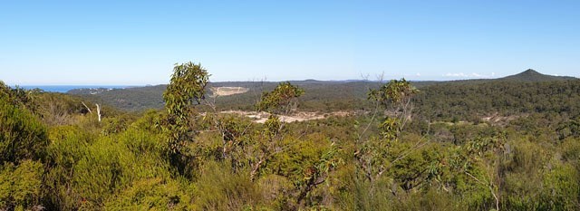
A short bushwalk to a vantage point offering expansive views from Mount Wondabyne to the sea. From the parking waypoint off Woy Woy Road, follow the Tommos Loop fire trail west for about 200 metres to the crossroads. Turn left onto the ML9 Loop fire trail and continue along to the reference point. From there, just follow the rock shelf to GZ. The cache is on the top level and well back from any edges, there's no need to climb down the rocks.

This area of land excised from Brisbane Water National Park is the site of a disused sandstone quarry. Some of the pits, now filled with water, can be seen from here. To the south-west is the conical profile of Mount Wondabyne, wrongly believed by some to be an ancient volcano. It's actually just a small peak on the end of a ridge line and only appears conical when viewed from the north. To the south-east is the Pacific Ocean beyond Broken Bay, with Barrenjoey lighthouse and the vertical cliff of Little Head at Whale Beach beyond that.
The container is a low profile Duratech ABS instrument case with a pencil included.