£10 Worth of Water Trough (Dunedin, Otago) Traditional Cache
£10 Worth of Water Trough (Dunedin, Otago)
-
Difficulty:
-

-
Terrain:
-

Size:  (small)
Please note Use of geocaching.com services is subject to the terms and conditions
in our disclaimer.
A park and grab at an historic water trough on the Mt Cargill Road. There are good pull-off areas on both sides of the road. Wheelchair accessible with grabber.
GPS coverage is variable, but you will find the 1 litre screwtop right beside the trough. The previous cache here was muggled twice within a month - so please cover the top of the cache with some leaf litter and rearrange the foliage to ensure it is completely hidden.
Why "£10 worth of water trough"? Well...
Until 1956 this was the main north road and Neil O’Fee, the Waitati butcher in the 1920’s and 30’s, didn’t always keep to the speed limit. The local cop was on the lookout and pulled him over by this very water trough. Neil didn’t like the dressing-down he was given and, being a hefty fellow, picked up the policeman and dunked him in the water trough. The officer climbed out and told Neil “That will cost you five pounds in court” (a lot of money then, with wages around £4/week). Neil replied “Well, I think I will have ten pounds worth” and dumped him back in again!
Feel free to dunk yourself as much as you wish – the water here is (almost certainly) safe to drink. Cyclists refill their water bottles here, and many people who don’t like treated water use this supply. If you look on the shelf behind the trough there’s a home-made funnel for filling jerry cans.

This watertrough was here in 1875; presumably it was built when the road was constructed, sometime between 1860 and 1863. (The stone part at least- the concrete frontage looks more recent.) 150 years ago, the new settlement of Dunedin desperately needed a good road connection north to Blueskin (Waitati) and Waikouaiti to replace the dangerous Mountain Track and the tortuous Tuckett’s track.
 In October 1856 J T Thomson, the Chief Surveyor of Otago, determined a road line from North East Valley to Blueskin. In 1858 this planned main northern road over the Mihwaka and Signal Hill ranges was surveyed at a 1 in 16 gradient Otago Witness, 20 August 1859.
By March 1860 a 4 foot wide bridle track to Blueskin had been cleared, stumped and metalled. In April it was declared a “Main Line” and the Otago Provincial Council voted funding to widen it to a coach road.
The gold rush to the Dunstan via Waikouaiti and Shag Valley in August 1862 and Naseby in 1863 made further development urgent. The road was opened to Hawksbury (Waikouaiti) at the end of 1863 with the Waikouaiti River bridge being completed in 1864.
Toll houses were erected at the Water of Leith (Gardens), Blueskin, Waikouaiti and Pleasant Valley in 1864 to fund road maintenance. The tollhouse-keepers tendered to the Provincial Council each year for the right to collect the tolls which formed their income. Receipts at each toll bar approached £1000 in the 1870s. Tolls weren’t popular...
OW 16 April 1864 A question of considerable interest was raised in the case of Boyd v. Hay. It appears that the keeper of the toll-bar at the Water of Leith has been in the habit of charging the same rate of toll upon horses and carts on their going and returning through his gate on the same day. The plaintiff in the case denies the right of the toll-keeper to charge any toll for a horse and cart returning through the gate on the same day, and maintains that it is contrary to the Turnpike Ordinance, 1862. As the decision in this case will no doubt rule the conduct of all the other keepers of toll-bars in the Province, the magistrate took time to consider his decision.
ODT 15 Aug 1877 CIVIL CASES- Bonner v. Smith—Adjourned case, for the recovery of L1 Os 6d, tolls due to the Blueskin toll gate. Mr Dick for the plaintiff. Cases further adjourned to September 11th for the production of the defendant's deed of lease.
OW 27 July 1878 A charge of assault which arose under rather peculiar circumstances came before the Police Court on the 18th. A rider passing through the toll gate at Blueskin refused to pay, and the tollkeeper took off the defaulter's hat and went away with it, saying ''This will do for the sixpence." The tollkeeper was fined 5s and 25s costs.
 The Schedule of toll charges was complex and depended on factors such as the kind of wheeled vehicle, the number of harnessed animals, the number of stock and the job of the individual traveller. For example, in 1876 the toll for a ridden horse was 6d, most vehicles 1/-, steam vehices 5/-, but any springless vehicle with wheels five inches broad was charged half the usual rate. Cattle were charged 3s/4d for 20, other stock 10d for 20.
The Clarendon Toll House is the last surviving Otago toll booth; see it at Toll Booth cache.
As soon as the road was opened Mr T M Smith started a three-horse covered express service between Waikouaiti and Dunedin. Fares were 7/6d for passengers and 1/- for small parcels. As the road improved he was able to make a return trip in one day.
On 24th February 1864 Cobb & Co began a service to Waikouaiti using an open wagon on leather braces. The new road was soft and narrow; passengers frequently had to walk to allow the horses to get through the worst pinches. By April the road was good enough for a four-horse coach to be used. At the end of May a two-day-return service to Waikouaiti was established, with horses changed at Carey’s Blueskin Hotel and from 1866 at the Waitati Hotel. The fare from Dunedin to Blueskin was 15/-.

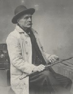
The best-known Cobb & Co coach driver was Ned Devine, whose whip you can see in the Early Settlers Museum.
One day the early settler, farmer and ship-owner John Jones was on the box with Ned, travelling between Dunedin and Jones’ farm at Matanaka. “I hear, Mr Jones”, remarked the doughty whip, “that you are giving each of your daughters £10,000 when they marry – is that right?” “Yes”, replied the prosperous John, “that’s right – they’ll each get £10,000”. “Well!” said Ned, with a sideways glance at his companion. “Look here, Mr Jones, I’ll take Janet for five.”
 ODT proofreader and columnist Peter Thomson “Pakeha”, off on a Holiday Ramble, was driven over the Mt Cargill Road by Ned Devine in February 1872. There was a major fire on Mihiwaka at the time:
On arriving at the summit above Blueskin, the effects of the heat were everywhere apparent in the enormous destruction caused in the forest on both sides of the road. On that particular morning the fire which had begun in the bay below Port Chalmers was then blazing away on the top of Mihiwaka, some 1500 ft above the place where it originated; and all round the hill fire was more or less visible while in the great bush on the north side of Mount Cargill a line of thick smoke, extending for miles, could, be seen. The destruction of the timber in this locality is much to be regretted … Meanwhile the coach, under the skilful pilotage of the well-known Devine, dashed through the smoke, and kept rolling along, up hill and down dale, until in due time the writer was dropped at the gate leading to his friend's house.
 English novelist Anthony Trollope visited Dunedin in the winter of 1872. He wrote that the road north from Dunedin was “as good as any in England” and was particularly impressed with the view.
Leaving Dunedin, we rose up a long wooded hill, with a view to our right over the land-locked arm of the sea down to Port Chalmers, which is the port for Dunedin. It was a most lovely drive. The scenery of the whole country round Dunedin is beautiful, and this is the most beautiful scene of it all.
In December 1875 Murray Thompson (a coachbuilder at Cobb & Co and, yes, son of Peter) and his new wife Grace travelled on Ned Devine’s coach as they left on their honeymoon in Clyde:
 Leaving here we turned into King Street at a fair speed, then down the North-East Valley and up to the Junction Hotel, where a man waited with buckets of water for the panting horses. We then trotted along a fine length of road that would be hard to beat in any part of New Zealand. The great pine trees in the virgin bush towered high overhead. This passed, we found ourselves driving down the hill to Blueskin. As only a master whip could, Ned, without easing his speed, guided the team round the big bend at the water troughs. At the old Blueskin Hotel we pulled up. Here Ned Russell, groom in charge, waited with a team of fresh horses...
The watertrough was always a Mt Cargill Road landmark; the Otago Witness 30 April 1891 reported “the double culvert at the water trough on the Main North road, near Mount Cargill, was very much worn” and needed replacement.
 By the turn of the century the Main North Road was “an excellent macadamised highway”. Gradually horses gave way to the motor car, but the watertrough continued to be an essential water supply for motorists – as ernienz recounts in Time for a Drink:
I remember this area from tales my Father told me of all the cars traveling to the House of Pain (when rugby was still worth going to see ) and stopping here to top up their radiators in the days before the motorway was opened.
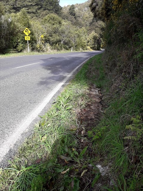
 During World War 2 there was a military road block 200 yards up from the horse trough corner. This would have been like the Harington Point road block, with concrete cylinders ready to be rolled across to block the road. Walk up the road to see the concrete foundations on either side of the road, 5 m up from the "25 km bend" sign, by the orange marker 5702.
Finally in 1956 the Northern Motorway, worked on sporadically since the 1930’s, was completed. Mt Cargill Road is now the scenic route for cyclists, who enjoy the easy 1 in 16 gradient, and of course geocachers.
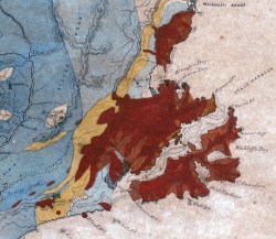
 The rugged hills traversed by the Mt Cargill Rd are basalt, the eroded remnants of the Dunedin Volcano. It erupted 13 million years ago in the shallow seas which then covered coastal Otago. The approximate centre of the volcano was Goat Island halfway down the harbour. Many eruptions and lava flows over the next three million years built a huge shield volcano, perhaps 1000 metres high. In the 10 million years since the Dunedin volcano became extinct, streams eroded away the centre of the volcano. A later rise in the sea level flooded these valleys to form the scenic Otago Harbour. James Hector’s 1864 geological map of Otago shows volcanic rocks in red; the GNS New Zealand Geology Web Map shows them in pink.
The bush here is slowly regenerating after the fires over a century ago. Since 1994 the bush above the road has been protected under a Queen Elizabeth II covenant. The property is owned by the Initial Volco Trust, a VOLuntary CO-operation group set up by Lloyd and Dorothy Morris in 1976 promoting “healthy, humane and sustainable living”. You will see the Volco farmhouse on the bend at #524. Dorothy and Lloyd left Ontario in 1962 when a nuclear power station was built there. Injuries in a car crash on the Northern Motorway forced them to stay in Dunedin during convalescence, and they bought this property on Mt Kettle in 1968. The Initial Volco Trust has regular open days, usually during Conservation Week, when you can see their rimu trees (one so large it takes three people to encircle it) and the remains of an old hotel on Cedar Creek.
When a friend was driving home past the watertrough at midnight a few years ago he was startled to see two people, caught like possums in the headlights, bathing in the trough by moonlight... have you got a watertrough story?
Information:
Old Coaching Days in Otago and Southland E M Lovell-Smith
Northern Approaches C W S Moore
Blueskin Days Ian Church
A Pakeha's Recollections Murray Thompson https://genealogy.ianskipworth.com/pdf/pakeha.pdf
There is plenty of room in the log book to put in the date that you sign it. Because the date can be important for some challenges, logs without a correct date may be subject to deletion. I will use my common sense and discretion as we all make genuine mistakes at times.
Additional Hints
(Decrypt)
pbeare,tebhaqyriryoruvaqsreaf