Historic Dartmouth Multi Multi-Cache
-
Difficulty:
-

-
Terrain:
-

Size:  (small)
Please note Use of geocaching.com services is subject to the terms and conditions
in our disclaimer.
A six part multi that takes you to a number of historic Dartmouth buildings & areas.
The posted coordinates above will lead you to the first of five clues. You may begin your search at the first clue (indicated below as waypoint A) but it is not necessary as the waypoints may be visited in any order. Although many of the clues are visible as you drive past them, some of the clues will require you to leave the comforts of your vehicle.
When you have all the information, use the following to locate the final cache:
N 44°40.XXX W 063°34.YYY
XXX = (A+B+C+D+E) x 3
YYY = (A+B+C+D+E) x 5 + 21
Checksum - Northing: 27 Easting: 35
There are numerous trailheads and parking areas for the final cache, a short bushwack is required. The final cache is a camoed lon-n-loc with swag to trade. “First to Find" prize is a Timmy's on me!
THE FINAL WAYPOINT IS NOT WINTER FRIENDLY. IF THERE IS ANY ACCUMULATION OF SNOW IT WILL NOT BE EASILY FOUND. ALL THE WAYPOINTS SHOULD BE NO PROBLEM IN THE SNOW
Click on any of the small photos to see a larger version.
Waypoint A - Dartmouth Ferry Landing
N 44° 39.851 W 063° 34.097
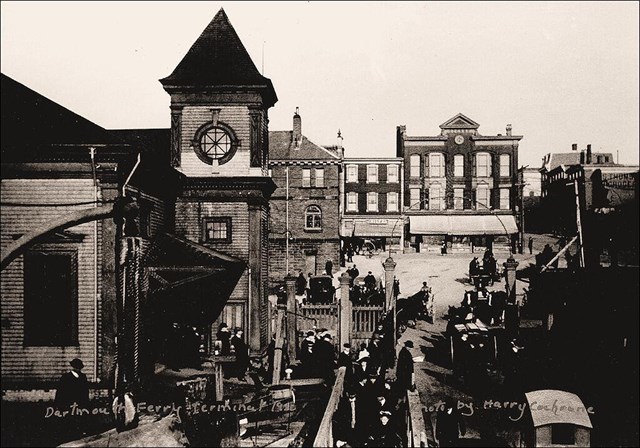
The Dartmouth ferry landing, with its connection to Halifax, was the heartbeat of the community. Most shops and trades set up within easy access to it, and it was in the center of the downtown business core. This photo shows the ‘new’ ferry terminal building with its three story tower built in 1906. Looking up steamboat hill, Sterns Corner is still easily recognizable today. The Stern Building, built in 1849, is said to be the first brick building in Dartmouth.
Waypoint 1 Clue: Find the large Street Numbers on the Sterns Building Window: _ _ = A
Waypoint B - Acadia Sugar Refinary
N 44° 38.964 W 063° 32.919
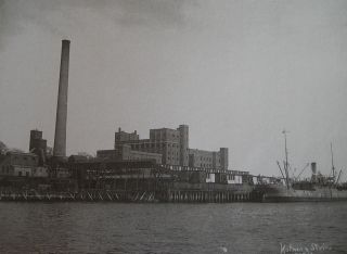
The Acadia Sugar Refinery operated from 1884 to 1942. Acadia Sugar Refinery was largely responsible for the development of Woodside as a community, building company housing in 1886 for the employees, which in turn lead to churches, schools and other community services. The original factory was destroyed by fire in 1912 but rebuilt within two years, with daily production of two thousand barrels of granulated sugar. The refinery was closed permanently during World War II and remained vacant until the 1970's, when a Volvo assembly plant open briefly on the site before moving to Halifax. The land and factory were sold in 1974, and the buildings were torn down a short time later.
Waypoint B Clue: Find the number of front doors on the Woodside ferry terminal building: _ = B =
Waypoint C - Starr Manufacturing Building
N 44° 40.164 W 063° 33.788
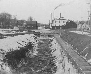
The Starr Manufacturing Company was a fixture in Dartmouth business for over 130 years. John Starr began the business as a nail factory in the 1860’s, but the company diversified into manufacturing railroad spikes, nuts, bolts, railway coal cars, bank vaults, doors and even the gates to Point Pleasant Park in Halifax. In 1884 the company constructed a two hundred foot swing drawbridge span for the railroad trestle at the Harbour narrows. Its crowning achievement was as the world leader in the design and manufacture of skates – shipping more than eleven million pairs of skates worldwide. They stopped making skates in 1938, but the company continued to operate until its closure in 1997.
Waypoint C Clue: Find the number off floors on the new apartment building at the Starr Manufacturing Site: _ = C
Waypoint D - Dartmouth's First Covered Rink
N 44° 40.099 W 063° 34.543
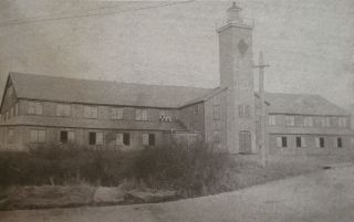
Dartmouth’s first covered rink, complete with electric lights opened in 1884, on Synott's hill, adjacent to the present-day Holiday Inn on Wyse road. Two thousand people attended the gala opening event for a concert. Entirely built of spruce at a cost of $3,800 the building measured 190 ft by 65 ft with an oval ice surface. A lighthouse was added in 1907. Spectators watched from a gallery that encircled the second floor. For thirty three years, the rink became the hub of Dartmouth’s winter events. The rink was razed by fire during the 1917 Halifax Explosion. The new brick Park School was built on the site in 1918.
Waypoint D Clue: Find the number of large pine trees at the waypoint, site of the former rink: _ = D
Waypoint E - Lake Banook Ice Houses
N 44° 40.468 W 063° 33.753
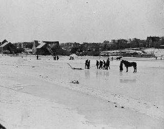
In the days before electrical refrigeration, Dartmouth was know as the “ice emporium”. The first man to cut ice was Adam Laidlaw, in 1836. He sold it to William Foster, who ran advertisements for “ pure Dartmouth Lake ice” and peddled it from his store at the Halifax Ferry Landing by means of two horse drawn carts. In the beginning, a fee was paid to the Subenacadie Canal Company, because they owned the water rights to Lake Bannook and Lake Micmac. The annual yield reached 125,000 tons in 1930. Ice houses, used to store ice, dotted the banks of lake Banook. The largest ice houses could hold over 3,000 tons of ice. The annual ice harvest continued for nearly 120 years until a “crop failure” due to mild winter temperatures in 1950-1951 coupled with the recent affordability of modern fridges, permanently closed the enterprise.
Waypoint E Clue: Find the Lock # of the nearby Shubie Canal Lock (find the canal information sign near waypoint): _ = E
(sources: Historic Dartmouth (M. Parker) & NS Archives)
Geochecker Added July 2011: 
See my other historic multi-cache : Historic Cole Harbour Multi

If you are a Geocacher in Atlantic Canada,
please join us. The ACGA is your gateway to
caching in and around the East Coast.
Additional Hints
(Decrypt)
Svany - ng onfr bs ovepu gerr