|
Deutsch
English
Francais
|
|
 Natuurpark Hoge Venen Natuurpark Hoge Venen
|
| |
|
Tijdens een kleine
vakantie in dit gebied leek het ons leuk om deze cache hier als
aandenken te plaatsen.
|
| |
|
De Hoge Venen
maakt deel uit van de Eifel dat zich uitstrekt van Duitsland tot
hier in België. De Hoge Venen is het kloppende hart van de Eifel en
tevens het meest typische en kwetsbare gebied. De Hoge Venen zijn
overdekt met veel duizenden jaren oude hooggelegen venen, wat voor
West-Europa zeer uitzonderlijk is. In de Hoge Venen is tevens
Signal de Botagne te vinden, dat met zijn 694 meter het hoogste
punt van België is.
|
|

|
| |
|
Het Natuurpark
Hoge Venen - Eifel verbergt zeer kwetsbare gebieden. Het is dan ook
van het grootste belang om niet van de aanbevolen wandelpaden af te
wijken en de huisregels, in alle omstandigheden in acht te nemen.
Alleen wanneer deze twee voorwaarden worden nageleefd kan het Hoog
Plateau voor het groot publiek toegankelijk blijven.
|
|
Flora en
fauna
|
|
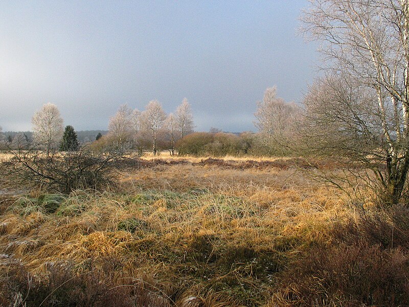
In het
hoogveengebied zijn kenmerkende heide- en veenplanten te vinden,
zoals struikhei, dophei en veenmos. Ook bloemen en planten die
kenmerkend zijn in berggebieden, zoals orchideeën, gentianen,
zonnedauw, veenbes en veenpluis voelen zich er thuis. Omdat de
beweiding de laatste decennia verwaarloosd werd, maar ook als
gevolg van stikstofdepositie en ontwatering, zijn daarnaast
struikplanten en het pijpenstrootje opgekomen. Ten zuidoosten van
de Hoge Venen bevinden zich velden met wilde narcissen.
De Japanse duizendknoop (Fallopia japonica) is er een woekerende
invasieve soort.
Bijzondere dieren zijn onder andere lynxen, edelherten, reeën,
wilde zwijnen en korhoenders.
|
|
Geologie
|
|
De geologie van de Ardennen en de Eifel (waarin de Hoge Venen
zich bevinden) zoals die vandaag de dag te zien is is het gevolg
van tektonische, sedimentaire en vulkanische gebeurtenissen en
processen die over een tijdspanne van miljoenen jaren plaatsvonden.
Het laaggebergte dat het huidige resultaat is van deze
gebeurtenissen en processen wordt het Rijnlands leisteenplateau
genoemd. De westelijke helft hiervan ligt in België, de oostelijke
in Duitsland. Kleinere stukken vallen onder Frankrijk, Nederland en
Luxemburg.
De Ardennen en Eifel zijn een geologisch massief, een door
tektonische opheffing omhoog gekomen gebied waar gesteenten uit het
diepere sokkel van West-Europa dagzomen (aan het oppervlak komen).
De kern van dit massief is zo’n 500 miljoen jaar geleden
ontstaan en geformeerd in een periode zo’n 300 miljoen
jaar geleden. Als gevolg daarvan worden ze doorsneden door een
uitgebreid stelsel van breuken en plooien.
Dankzij tektonische opheffing zo’n 30 miljoen jaar geleden is
het huidige laaggebergte ontstaan. Daarbij houden tektonische
opheffing en erosie elkaar ongeveer in evenwicht. Het gebied wordt
gekenmerkt door diep ingesleten rivierdalen, terwijl het reliëf
buiten deze dalen vrij vlak blijft. Ook tegenwoordig nog vindt
tektonische opheffing plaats: de Ardennen bewegen bijvoorbeeld ten
opzichte van Antwerpen met een centimeter per jaar omhoog.
|
|
Om deze cache
te kunnen loggen moet je:
|
-
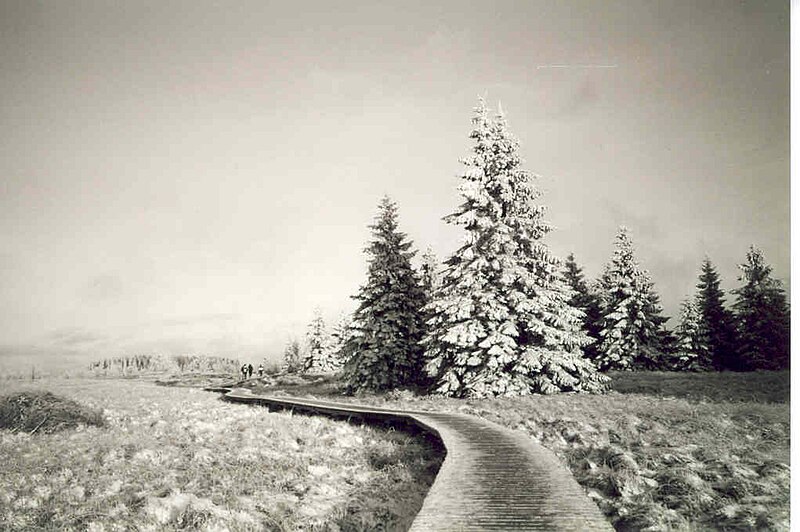
Een foto nemen met
daarop een teamlid met GPS, de informatieborden en de drie
karakteristieke bomen die hierbij in de buurt staan. Deze foto dien
je bij je log te plaatsen.
-
Beantwoord de
volgende vragen:
A. Hoe
groot is het gebied van de Hoge Venen in vierkante kilometer?
B. Hoe oud is het gebied?
|
| Stuur vervolgens een mail naar het volgende
e-mailadres: |
AantwoordBantwoord@gmail.com (voorbeeld:
A12B7500@gmail.com)
|
| Als je antwoorden goed zijn krijg je direct een automatische bevestiging en mag
je de cache als found loggen! |
| Logs met
verkeerde foto's of mails aan het verkeerde e-mailadres worden
verwijderd!!! |
|
|
|

|
| |
|
 The High Fens The High Fens
|
| |
|
The High Fens is part of the Eifel that
reaches out from Germany to here in Belgium. The High Fens is the
pounding heart of the Eifel en the most typical and vulnerable
area. The High Fens are covered with thousands of years old
highland Fens, this is very rare for the west European region. In
the high fens you can also find the Signal de Botagne this is,
with 694 meter, the highest point of
Belgium.
|
|
Nature park the High Fens is a very
vulnerable area. So it is very important that you follow the
recommended trail and always comply to the house rules. Only when
you comply these to conditions the High Fens maintain to be
accessible for the public.
|
| |
|
Geology
|
|
The geology of the
Ardennes and Eifel (The high Fens are part of this area) as we can
see today, is the result of tectonic, sedimentary and volcanic
processes that occurred in a million year time span. The
lower mountain range is the current result of the processes and is
named the Rhineland shale plateau. The western part is situated in
Belgium the eastern part is in Germany.
The Ardennes and Eifel are an geological massif. It’s
raised up by tectonic activities whereby deep laying rock is pushed
up to the surface. The core of this massif arisen over 500 million
years ago, and is deformed in a period about 300 million years ago.
Because of the deformation there is an array of fractures and
folds.
Due to the tectonic uplift 30 million years ago the current lower
mountain range arisen. Nowadays tectonic uplift and erosion are in
balance. The area is characterized by deep worn out river valleys,
while the topography outside the valleys is mainly flat. These
day’s there is still some tectonic uplift: The Ardennes Move
up for about 1 cm a year compared to Antwerp.
|
|
|
|
To log this cache you have
to:
|
-
Take a
picture of a team member with GPS in sight of the information signs
and the three characteristic trees in the background.
Upload
this picture with your
log!
-
Answer the following questions
A. How big is the High Fens
Area?
B. How old are the High Fens?
|
|
| Send an
email to the following e-mailaddres:
|
AanswerBanswer@gmail.com
(For
example A12B7500@gmail.com)
|
| If your answers are correct, you will get an automatic
reply and you can log this cache as found! |
| Logs with wrong pictures or logs without any right e-mail will
be deleted! |
|
|
|

|
| |
| |
|
 Der
Naturpark des Hohen Venns Der
Naturpark des Hohen Venns
|
| |
|
Der Naturpark des Hohen venns ist
Teil des Eifel, der sich über Deatschland ond Belgien erstreckt.
Der Naturpark ist dan Kernstück das typischste - aber auch das
ökologisch empfindlichste. Die in Westeuropa äußerst seltenen
Torfmoore, die viele tausende Jahre alt sind, bedecken das Land.
Beim Hohe Venn denkt man unweigerlich an das Signal de Botrange,
das mit seinen 694 m Höhe ganz Belgien überragt
|
| |
|
Der Naturpark Hohes Venn - Eifel
ist ein sehr Empfindliches natürliches Milieu. Deshalb ist es
wichtig, auf den empfohlenen Wanderwegen zu bleiben und sich unter
allen Umständen wie ein Gast zu benehmen. Nur auf dies weise kann
das Plateau weiterhin viel Besuchern zugänglich bleiben und Freude
bereiten.
|
| |
|
Die Bedienungen für das Loggen dieses Caches
sind:
|
|
1) Mach ein Foto mit darauf:
- ein teamlid mit wirkende GPS
- die Informationsschilder
- die drei charakterischen Baumen in der Nahe der
Informationsschilder
2) Schicke die Antworten auf die
folgende Fragen per E-mail uns zu
A. Wie groß ist das Gebiet der
Hohnen Venns?
B. Wie alt is das Gebiet?
|
| Bitte
sende eine E-mail zur folgende Addresse:
|
AAntwortBAntwort@gmail.com
(zum Beispiel:
A12B7500@gmail.com)
|
| Wenn Ihre Antworten richtig sind, entfangen Sie automatisch
eine Bestätigung. Nur dann dürfen Sie den Cache auch wirklich auf
das Internet loggen als gefunden. |
|
Logs ohne richtiges Foto werden entfernt. Das
Gleiche gilt wenn gelogd wird ohne das wir eine richtige E-mail
bekommen haben!
|
| |
|

|
| |
| |
|
 Hautes Fagnes Hautes Fagnes
|
| |
|
Les Hautes Fagnes
forment une région qui s'étend, en Belgique dans la Région wallonne
(province de Liège) et, en Allemagne, dans la Rhénanie-Palatinat et
la Rhénanie-du-Nord-Westphalie). En néerlandais, Hoge Venen, en
allemand, Hohes Venn. Bien que constituant un site de grande
importance à l'échelle nationale, les Hautes Fagnes, à l'inverse du
plateau des Tailles, ne font pas partie du Patrimoine majeur de
Wallonie.
Il ne faut pas confondre les Hautes Fagnes avec la Fagne, une autre
région naturelle qui s'étend en Belgique et en France.
Le Signal de Botrange (694 mètres) est le sommet de la
Belgique.
Ce sont de vastes étendues (4100 ha en Belgique) de tourbières et
de forêts qui présentent une flore et une faune assez
exceptionnelles liées au climat froid et humide. Les contreforts du
plateau accuille essentiellement de vastes étendues de conifères :
c'est la forêt du Hertogenwald.
Les tourbières se sont formées il y a milles ans, à la fin de la
dernière glaciation. La tourbe résulte de la décomposition des
végétaux, notamment les sphaignes, en milieu très humide. Son
épaisseur peut atteindre sept mètres. Jusqu'au milieu du XXe
siècle, la tourbe constitue pour les habitants proches, une source
de chauffage appréciable. La surface des tourbières actives ne
représente plus qu'une centaine d'hectares.
Le plateau des Hautes Fagnes est le plus important massif tourbeux
en Belgique. Les autres massifs importants sont le Plateau des
Tailles, le Plateau de Saint-Hubert et la Croix-Scaille.
|
|
Les conditions pour logger votre visiteles
sont:
|
|
1) Prendre un photo avec:
- à moins un
membre du équipe avec GPS
- les panneaux informatiques
- les trois arbres caractéristiques proche les panneaux
informatiques.
2) Répondre aux deux questions suivantes en m’envoyant
un email contenant vos réponses
A. Quel est la grandeur du terrain Hautes Fagnes?
B. Quel âge est le terrain Hautes Fagnes?
|
Envoyez un courriel à
l'adresse
suivante:
AréponseBréponse@gmail.com
(Par example A12B7500@gmail.com)
Si vos réponses sont
correctes, vous obtiendrez
une réponse automatique et vous pouvez vous connecter à ce
cache que l'on trouve!
Logs avec des
images fausses ou des journaux sans aucun
e-mail à
droite seront éloignés! |