The Moeraki Boulders (North Otago) EarthCache
The Moeraki Boulders (North Otago)
-
Difficulty:
-

-
Terrain:
-

Size:  (other)
Please note Use of geocaching.com services is subject to the terms and conditions
in our disclaimer.
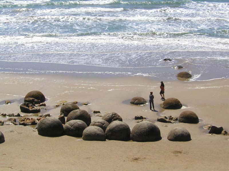
It looks like a scene from a science fiction movie; hundreds of
huge marble-like boulders are strewn along the windswept beach like
giant turtle eggs. That's what's been dumped on the sands at
Moeraki, just south of Oamaru.

Best seen at low tide, these beautiful spherical stones - some up
to 4 metres in circumference - can be seen emerging from the cliffs
and disappearing into the sand and the sea. The coastal elements
are slowly eroding the boulders into fascinating shapes and
uncovering new ones.
There's been a bit of debate as to how the Moeraki Boulders got
there - much of it rather colourful. According to Maori tradition,
the boulders are gourds and calabashes washed ashore from the
voyaging canoe Araiteuru when it was wrecked upon landfall some
1,000 years ago.
The reality is more about geology. These boulders were formed over
millions of years on the sea floor by a layering process similar to
the formation of oyster pearls. The seabed was uplifted to form
coastal cliffs that have eroded over time so the boulders tumbled
down onto the beach.
The most striking aspect of the boulders is their unusually large
size and highly spherical shape, with a distinct bimodal size
distribution. About one-third of the boulders range in size from
about 0.5 to 1.0 metres in diameter, the other two-thirds from 1.5
to 2.2 metres, the majority being nearly to almost perfectly
spherical. A minority of them are not spherical, being slightly
elongated parallel to the bedding of the mudstone that once
enclosed them.
These concretions were created by the cementation of the Paleocene
mudstone and the precipitation of calcite from pore waters of the
Moeraki Formation, from which they have been exhumed by coastal
erosion. The spherical shape of these concretions indicates that
the source of calcium was mass diffusion and not fluid flow.
Studies of the oxygen and carbon comprising the calcite cement and
spar comprising the Moeraki Boulders demonstrates that the main
body of these concretions started forming in marine mud near the
surface of the Paleocene seafloor. The larger, 2-metre in diameter,
Moeraki Boulders are estimated to have taken 4 to 5.5 million years
to grow while 10 to 50 metres of marine mud accumulated on the
seafloor above them.
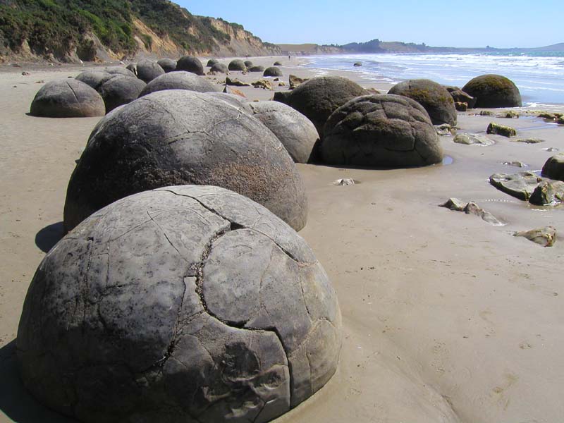
After the concretions formed, large cracks called septaria, formed
in them. Brown calcite, yellow calcite, and, in rare cases,
dolomite and quartz progressively filled these cracks when a drop
in sea level allowed fresh groundwater to flow through the mudstone
enclosing them. The process or processes that created septaria
within Moeraki Boulders, and in other septarian concretions, remain
an unresolved matter for which a number of possible explanations
have been proposed. These cracks radiate and thin outward from the
centre of the typical boulder and are typically filled with
calcite, which often, but not always, completely fills the
cracks.

To claim this Earthcache, please complete the following
requirements:
1. Take a picture with your group posing beside a boulder that you
find most striking. Make sure your GPS is visible in the picture.
Post your picture with your log.
2. Find a Moeraki Boulder that demonstrates a good example of
septaria cracks and take a picture of it. Post this with your log
and e-mail what material you think has filled these septaria
cracks.
3. Since the boulders are bimodal in size distribution, find a
boulder of each size group as listed above. Take the circumference
and diameter of the two boulders and include this information in
your e-mail. You will need to bring a tool to take these
measurements. Send this e-mail when you post your visit.
Much of this information was taken with thanks from:
http://www.answers.com/topic/moeraki-boulders
Additional Hints
(No hints available.)