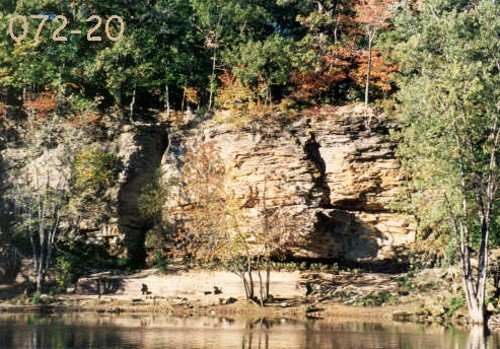
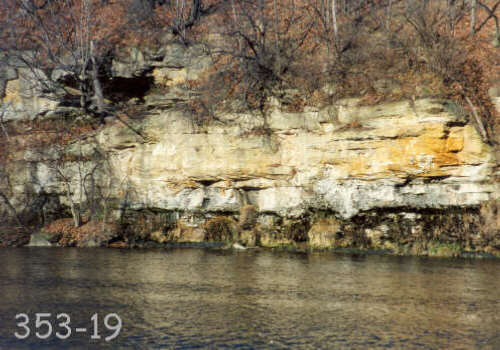
Welcome to the Ledges in Grand Ledge Michigan. The ledges were
formed by the Grand River as it flowed towards its mouth at Grand
Haven on Lake Michigan. They stretch for approximately one mile
along this part of the Grand River. The river is still in the
process of adjusting its course by eroding one side of the bank and
depositing the sediments on the opposite side of the river.

Through the years, people have found many uses for this area. In
the early part of the century, there was a resort along the river.
The islands that housed this resort were known as the Seven
Islands. Legend has it that during a time of Indian wars, a mother
feared her children would be captured. She put them in a canoe and
started down the river. One by one she dropped each child into the
water to hide them and where each of her children hit the water, an
island sprang up. The ledges were used by Native Americans, led by
Chief Okemos, as shelter while passing through the area. There are
even legends that the once-abundant caves formed by the ledges,
with names such as Robbers Cave and Counterfeiters Cave, were used
for hiding stolen horses that were awaiting sale and also to harbor
slaves escaping to Canada. The area has also been used for its
mineral wealth. At one time coal was being mined along the river
banks. Veins of coal can still be found along the path between
Island Park and Fitzgerald Park.

Some more technical information.....
Approximately 270 million years ago, much of this area of
Michigan was covered by water. Sediments carried by flowing water
were constantly being deposited in layers along the river banks and
beaches. Over time, these sediments were compacted into the rock
layers that are evident today. If you feel the rock, you will
notice that the sedimentary rocks still feel sandy.
If you are interested, there are pamphlets available to guide
you along a self-guided tour. I highly recommend these.
Logging Requirements as of 12-27-06
In order to log this cache as found, visit the coordinates
above. Depending on the accuracy of your GPS, you will see a wooden
marker with either a #3 or a #4. The markers are between the path
and the ledges. Please estimate the height of the ledges at either
of these points and email that number to me through the email
address in my profile. Thanks and enjoy!

The images on this page came from the Ledges of Grand
Ledge website. Visit it to see many more great pictures of the
Ledges.