Budapest Border
Trail

Budapest Magyarország fovárosa, majd’ 2 millió lakosa
van, területe 525 km2. A városról bovebb információért
látogass a Wikipedia
oldalra.
Jelen vállalkozásunk egyedülálló a maga nemében, Egy
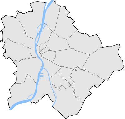
különleges powertrail ez, melynek keretében a fováros határvonalára
rejtünk ládákat. Ha végig szeretnéd járni, számolnod kell a
következokkel. A határvonal és így a ládák össz távolsága több mint
130km. Az egészet égtájak szerinti szektorokra osztottuk.

Vedd komolyan a terep/nehézség értékeket, van ahol komoly
eszközökre lesz szükséged a megtaláláshoz. A trail egy része
Nemzeti Park területére esik, így a bejárás kizárólag gyalogosan,
vagy kerékpárral lehetséges, ezt az attributumok jelzik. Így, ha
autóval közelíted meg a ládákat, megadunk ajánlott parkoló
pontokat. Itt sok esetben csak néhány kocsi fér el. Minden láda
megtalálásához segítséget adunk.
Minden ládában találsz egy FTF matricát, ezek összegyujtésével
nevezhetsz a Budapest 2011 – MEGA HUNt versenyen. A
szabályzatot megtalálod a regisztrációs csomagban.
Budapest Border
Trail

Budapest is the capital of Hungary, with almost 2 million
citizens, its area is 525 km2. For more information
about the city please visit the Wikipedia
site.
Your mission is unique - this powertrail is very special - we
have hidden geocaches along the boundary of Budapest. If you plan
to collect every single cache, you must calculate the following: The border (distance between the caches) is
more than 130 km long. The area is divided into 8 sectors (
example: NW - North-West)

Please take seriously the terrain /
difficulty levels, there will be hides where you'll need special
tools to find the cache ( example: rope, helmet, etc.)
Some parts of the trail lead through Nature Reserve Area where you
can ONLY use bicycle or you can pass on foot. You can check them at
the attributes of the geocache. We will recommend parking places
for cars, where it is possible. Please note: there are limited
places in most areas. You will be given hints for every cache often
with a spoiler picture.
If you are the first to find a cache you
will find an "FTF-ticket" in each one. Collect as many tickets as
you can to win the MEGA HUNt competition.
You will find the detailed rules of the
competition in your starting package!