TETIM NA MAIA
EARTHCACHE
PORTUGUÊS

A MAIA
Maia é uma freguesia rural açoriana do concelho da Ribeira Grande, com 21,97 km² de área e mais de 2 000 habitantes, o que corresponde a uma densidade populacional de 86,5 hab/km². A localidade localiza-se na costa norte da ilha de São Miguel, entre as freguesias de São Brás, a ocidente, da Lomba da Maia, a nascente, e os concelhos de Vila Franca do Campo e Povoação, a sul.
Algumas questões geológicas
“No sector norte da ilha de São Miguel, desde o Calhau do Cabo até à Ponta de S. Brás, predominam, na costa, os afloramentos de espessas escoadas lávicas de natureza traquítica, sobre as quais se encontram depósitos piroclásticos de natureza pomítica. Em alguns sectores da costa, encontram-se, sobre estes depósitos pomíticos, novas escoadas lávicas traquíticas.
Na Maia e Lomba da Maia encontram-se também lavas traquíticas, contudo em menor proporção, quando comparadas com os afloramentos de rochas basálticas.
As rochas basálticas encontram-se expostas no Porto Formoso e S. Brás, mas os seus afloramentos vão sendo mais frequentes para o sector leste da área de estudo. Na Maia estas lavas têm maior representatividade, formando a fajã sobre a qual se desenvolve o povoado da freguesia”.
No Local da Maia, podem observar-se Formações Holocénicas, que correspondem estas formações aos aluviões, depósitos de vertente, terraços fluviais, depósitos de areias eólicas e areias de praia.

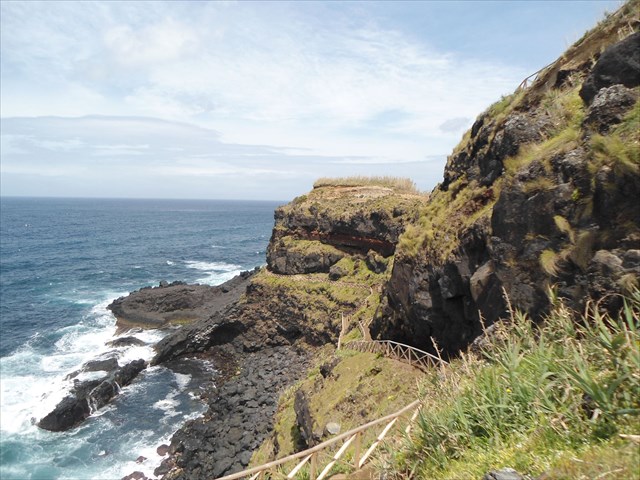
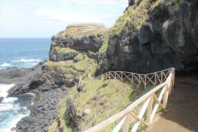
Na zona do GZ desta earthcache são visíveis diversos fenómenos geológicos, nomeadamente e entre outros: escoadas lávicas, diáclases, piroclastos, filões, disjunção esferoidal, etc…
O TETIM
As massas basálticas num filão, durante a fase de ascensão, encontravam-se a temperaturas superiores a 1000 graus Celsius, sob grande pressão tectónica.
Desse modo, os basaltos "cozeram" a pedra-pomes (amareladas a esbranquiçadas) e os paleossolos (estes de tons acastanhados) como se trata-se de um forno de olaria. Daí resultou um novo material, avermelhado claro a avermelhado forte, bem visível e foi usado como aditivo ás pinturas de casario e até em tinturaria (o denominado " tetim"). Com o tetim pintavam-se as bordaduras de portas e de janelas exteriores; também se tingiam tecidos grosseiros.
PARA REALIZAR E REGISTAR ESTA EARTHCACHE:
PERGUNTAS:

Para “encontrar/registar” esta cache deverá: provar que esteve no local e responder às seguintes questões, enviando um email/mensagem de Geocaching, com as respostas, em português ou em inglês, para o nosso perfil.
Só depois, de enviar as respostas, e conforme as “guidelines” para as Earthcaches, deverá efectuar o seu registo!
Serão removidos todos os registos que não obedeçam a estes requisitos.
1. Depois de observar o local do GZ, responde às seguintes questões:
Identifica, pelo menos, seis ”fenómenos geológicos” visíveis no local.
2. Observando o way point 1, responde às seguintes questões:
a) Faz, por palavras tuas, uma descrição do que é visível na falésia, do ponto de vista geológico, neste ponto de observação (WP1).
b) Identifica o tipo de rochas e suas cores, que são observáveis neste local.
c) Qual a cor da camada de rocha imediatamente acima da camada de tetim? E abaixo?.
d) Estima a largura/altura da camada de tetim, visível, na falésia?
e) Explica o que é o “tetim”, como foi formado e para que serviu, nos Açores, no passado.
3. TAREFA OBRIGATÓRIA:Deverá tirar uma foto sua, onde você apareça (ou com um papel/placa onde conste o seu nickname e a data da visita) e que comprove a sua presença no GZ desta EC - NÃO METAM SPOILERS. Esta foto deverá ser colocada no seu registo ou enviada por email ou sistema de mensagens de Geocaching, para o owner!




"TETIM" AT MAIA

EARTHCACHE

ENGLISH

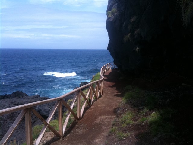
“MAIA”
Maia is a rural parish of the Azorean region of Ribeira Grande, with 21.97 km ² of area and more than 2 000 inhabitants, corresponding to a population density of 86.5 hab / km ². The locality is located in the north coast of the island of São Miguel, between the parishes of São Brás, to the west, Lomba da Maia, the source, and the municipalities of Vila Franca do Campo and Povoação, to the south
Some geological issues
"In the northern sector of the island of São Miguel, from Calhau do Cabo to Ponta de S. Brás, the outcrops of thick lava flows of trachytic nature predominate on the coast, on which there are pyroclastic deposits of a Pomitic nature. In some sectors of the coast, there are, on these pomitic deposits, new trachetic lava flows.
In Maia and Lomba da Maia, there are also trachytic lavas, but to a lesser extent, when compared to the outcrops of basaltic rocks.
The basaltic rocks are exposed in Porto Formoso and S. Brás, but their outcrops are more frequent for the eastern sector of the study area. In Maia these lavas have greater representativeness, forming the fajã on which the village of the parish develops ".
In the Place of the Maia, Holocene Formations can be observed, that correspond these formations to the alluviums, deposits of slope, fluvial terraces, deposits of wind sands and beach sands.
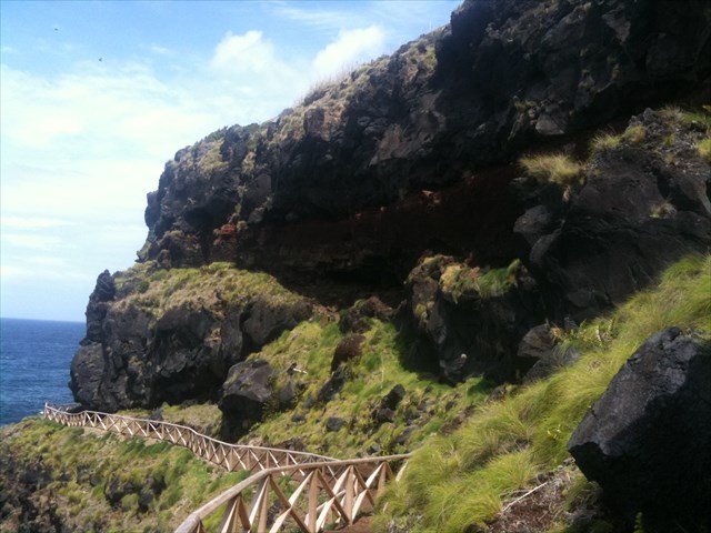

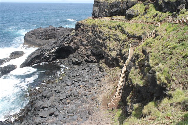
In the GZ zone of this earthcache are visible several geological phenomena, namely and among others: lava flows, “diclases”, pyroclasts, lodes, spheroidal disjunction, etc…
THE “TETIM”
The basaltic masses in a lode, during the ascension phase, were at temperatures above 1000 degrees Celsius, under great tectonic pressure.
In this way, the basalts "baked" the pumice (yellowish to whitish) and the paleosols (these of brownish tones) as if it were a kiln of pottery. This resulted in a new material, reddish clear to reddish strong, very visible and was used as an additive to the paintings of houses and even in dyeing (so-called "tetim"). With the canvas, the borders of doors and exterior windows were painted; also dyed coarse cloths.

TO PERFORM AND LOG THIS EarthCache:
QUESTIONS:

To "find / register" this cache should: prove that you were on the spot and respond to the following questions by sending an email / Geocaching message, with the answers, in Portuguese or English, to our profile.
Only then, to send the answers, and according to the guidelines for Earthcaches, you must register!
All records that do not meet these requirements will be removed.
1. After observing the GZ site, answer the following questions:
Identify at least six "geological phenomena" visible on the spot.
2. Looking at way 1, answer the following questions:
a) Make, by your words, a description of what is visible on the cliff, from the
geological point of view, at this point of observation (WP1).
b) Identify the type of rocks and their colors, which are observable in this
location.
c) What is the color of the rock layer immediately above the layer of fabric?
And below ?
d) Do you estimate the width / height of the visible tectonic layer on the cliff?
e) Explain what "tetim" is, how it was formed and what it served in the Azores in the past.

f) TASK (not optional): You must take a picture of yourself, where do you show up, (or with a paper / plaque with your geocaching nickname and the date of the visit) and that proves your presence in the GZ of this EC - no spoilers please. This photo must be placed in your log or sent by email or Geocaching messaging system, to the owner!
