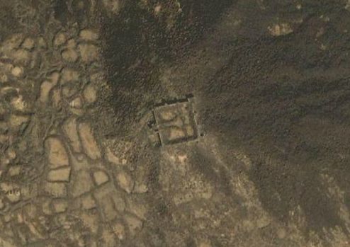
The first time I have seen this fortress it was on the Google satellite
image. I was planning some trips around my university and spotted a
man-made rectangle on a hill, not far away from the road (the road is
now paved even the image does not show it).

Then I started looking for some information about this ruin. And I
found very little. Most available articles mentioning village and wadi
Khulais are about the water management and hydrogeological
conditions. In the past, the area of three wadis around had reasonable amount
of groundwater allowing to grow fruits and crops. Later, however, the
water became a source for Jeddah desalination plants which lead to a
significant decrease of water here.
East of the village, there is a wadi with few farms with occasional
river. It is worth to explore it even for sporadic
bird-watching. Further exploration may lead you to the Al Murwan
Dam. I also found a web site
(http://www.arabfisheries.com/Projects/Khulais/default.aspx) about a
small freshwater Tilapia (http://en.wikipedia.org/wiki/Tilapia) farm
and hatchery - but I was not able to locate it.
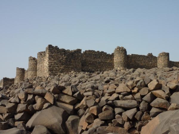
The history of the Turkish fortress is, however, still a big
unknown. It was definitely a part of the range of fortresses of the
Ottoman Empire, built to protect caravans and trade routes. Some
sources calls it an Ottoman stone castle, and it is larger than the
castle in the near Asfan (Usfan).
The village Khulais (it is even recorded in the list of towns of Saudi
Arabia) was here, however, definitely long before the Turkish
castle. It was used by pilgrims coming from Syria and Turkey on their
way to Mecca.

While looking for this cache, you can enjoy magnificent panoramas over
the green wadi. The rock upon which the castle is built - and where
you need to walk to find the cache - consists of massive Harrat basalt
boulders and the castle ruins likewise.
Notes about the cache
From unknown (to me) reasons, the cache projection on Google maps
shows it in the middle of the castle (I used, however, two independent
GPS devices and both showed the coordinates that I gave to this
cache). If in doubts, please see the hint (including a spoiler
photo).
Please cover it by stones as it is now. Otherwise, we will loose it again.