
Sedlo (Ceské stredohorí)
vrchol/ summit > 726 m n. m.
pohorí/ range> Ceské stredohorí / Vernerické stredohorí / Litomerické stredohorí / Trebušínská hornatina
horniny/ minerals> cedic a znelec/ basalt and phonolite
poznámka/ note> druhý znelcový vrchol s výškou 534 m/ secondary phonolite summit 534m
povodí/ basin> Labe/ Elbe
Sedlo (také Vysoké levínské sedlo ci Levínské sedlo) je vrch vysoký 726 m nacházející se nedaleko od Libešic v Ceském stredohorí v okrese Litomerice. Je známý tež pod starším názvem Jelecský vrch nebo Jelecská hora.
Sedlo (also Levínské sedlo) is a 726m tall mountain situated close to Libešice in Ceské Stredohorí, Litomerice county. It is also known under the older names Jelecský vrch or Jelecská hora.
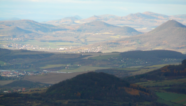
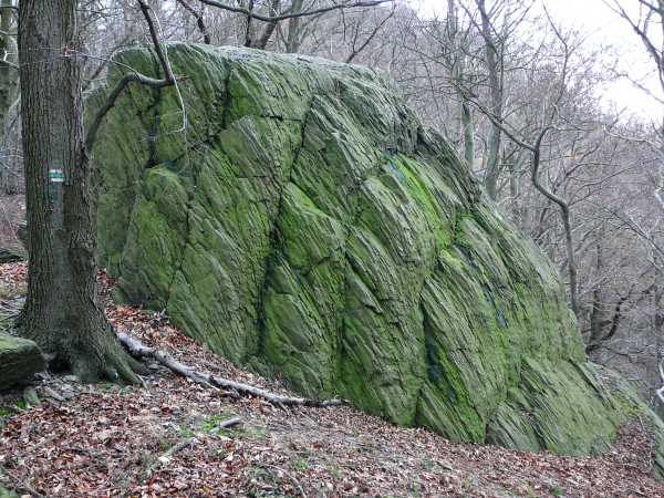
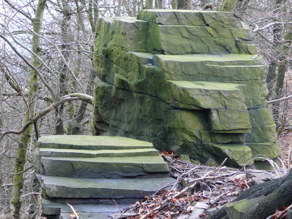
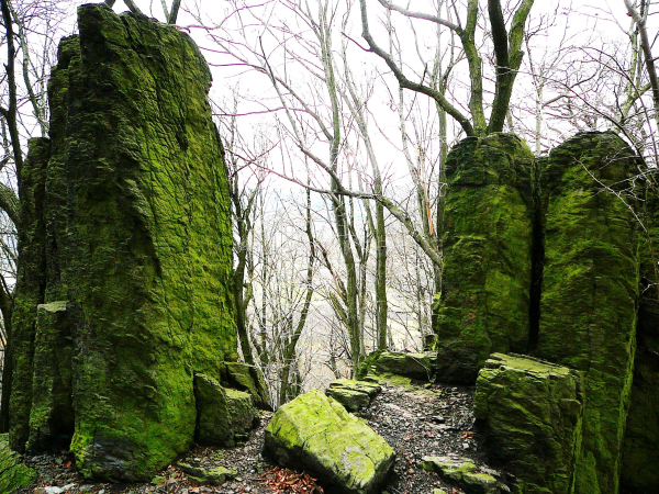
Jedná se o relativne vysokou solitérní horu se dvema výraznými vrcholy, která z dálky opravdu velmi pripomíná jezdecké sedlo. Celý mohutný trachydenzitový vrch je porostlý hustými lesy, Vrcholek hory je skalnatý a je tvoren velice malebnými skalními suky, skalními terasami s hranolovitou odlucností hornin. Celý vrcholek hory je chráneným uzemím (Prírodní rezervace Sedlo v CHKO Ceské stredohorí), nacházejí se zde zbytky puvodních listnatých lesu se vzácnou kvetenou. Z vrcholku Sedla je, díky jeho solitérnímu postavení a vysoké relativní výšce nad okolním terénem, velmi dobrý rozhled témer na všechny svetové strany a to do vzdálenosti mnoha desítek kilometru.
This is a relatively high, solitary mountain with two distinct peaks, which, from a distance, strongly resemble a riding saddle. The robust trachydenzite mountain is covered with dense forests. The peak of the mountain is rocky and consists of very picturesque rock patches, rock terraces and prismatic cleavage rocks. The entire top of the mountain is a protected area (national nature reserve, the Bohemian Uplands PLA). There are remnants of the original deciduous forests and rare flora. Given its dominant, solitary position and relative height above the surrounding terrain, the top of Sedlo offers spectacular viewpoints in all directions and dozens of miles of distance.
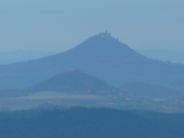
Vyšší vrchol se nazývá Velké Sedlo nižší vrcholek pak Malé Sedlo (534 m). Vrcholek Malého Sedla je znelcový. Na úpadí Sedla se také nachází menší vršek Litýš ze stejnojmennou hradní zríceninou. Sedlo tvorí také velmi výrazný optický protipól nedaleké hore Ríp, která se nachází jihozápadne odsud.
The higher peak is called Velke Sedlo and the lower one, Male Sedlo (534 m). Male Sedlo has a phonolite summit. At the foothill of Sedlo, a castle ruin, Litys, can be found on top of a hillock of the same name. Sedlo is a distinct optical counterpart to the nearby Rip mountain to the southwest, the legendary cradle of Czech settlement in the Bohemian basin.
zdroj/ source: wikipedia&owner. Our thanks to DieselJoe for his invaluable assistance :-)
Jak získat Earth cache>
Je více zpusobu jak trasu projít, ale doporucujeme peclive si precíst popis waypointu a postupovat dle nich. Provede vás to zajímavým koleckem kolem hory a nebudete se muset nikde vracet. Respektujte prírodu tak, aby ti kdo prijdou po vás nalezli stejnou krásu jako vy. Není treba riskovat! V zájmu vlastní bezpecnosti i ochrany tohoto unikátního místa se nepribližujte k okrajum skal. Nedoporucujeme za mokrého pocasí, snehu a náledí, také výhledy budou za pekného pocasí daleké a krásnejší.
1. Jakého puvodu je hreben (pen) Sedla?
2. Z jaké horniny je tento skalnatý vrchol Sedla tvoren? Uvedte také druh horniny. Odpoved má tedy 2 slova.
3. Jaká nejvzácnejší teplomilná kvetina se na Sedle vyskytuje? Je to kvetina, která je zmínena v anglickém textu. Uvedte její latinský název.
4. Jaký ráz mají zdejší lesní porosty? Uvedte také latinský název tvora, jehož dominantní výskyt je ukazatelem zachovalosti tohoto rázu lesních porostu.
5. Na jižní viste vyfotografujte váš zápis do kroniky hory. Logujte se svým kacerským jménem
6. Na souradnicích cache se vyfotografujte s vaší gps na dukaz vaší prítomnosti ve skalním amfiteátru, foto dole.
7. Fota priložte k logu a odpovedi pošlete zprávou pres profil.
How to get this Earth Cache>
There are several routes to follow, but we recommend that you carefully read the description of waypoints and proceed according to them. This will take you on an exciting tour of the mountain and you will not have to retrace anywhere. Respect nature, so that those who come after you find the same beauty as you did. There is no need to risk! For your own safety and preservation of this rare, unique place, don't attempt to get to the edge of the rock formations. The cache is not recommended in wet, snowy and icy weather; also the views are wider and more beautiful in fine weather.
1. What is the origin of the Sedlo ridge (stock)?
2. What mineral is the rocky peak made of? Indicate also the type of rock (the answer has 2 words, refer to line 3 of the largest paragraph in the CZ description of the plaque).
3. What is the most valuable species of heat-loving flowers growing on the rocks? Give the Latin name.
4. What nature is the mixed forest vegetation found under the rock formations? Also give the Latin name of the creature whose dominant presence is an indicator of the preserved nature of these forests (refer to the last animal mentioned in the Czech description of the plaque).
5. At the south vista, take a picture of your log in the mountain chronicle. Make the log using your cacher name.
6. At the cache coordinates, take a photo of yourself and your gps as a proof of your presence in the „rock amphitheater” , photo above.
7. Upload the pics with your log and send the answers through profile message
~~~~Štastný lov! Happy hunting!~~~~