 Norsk
Norsk
Viewpoint Rampestreken er en fantastisk opplevelse. Utsikten er 537 moh, og Åndalsnes er under føttene dine.
Fra startpunktet i Åndalsnes sentrum stiger stien bratt til den når utsiktspunktet, Rampestreken, 537 moh. Lokalbefolkningen elsker denne turen, og de gjør ofte dette for å trene for å bli belønnet med en fantastisk, fantastisk utsikt. Den er klassifisert som en moderat fottur, men den siste delen er ganske bratt - men håndterbar. Når du kommer til omtrent 430 moh, stier stien ned til steintrapper, der stien er gjort holdbar takket være fantastiske steinkonstruksjonsarbeider fra nepalesiske Sherpas. Verdt en studie selv, kalt Romsdalstrappa. Trinnene gir en solid sti mesteparten av veien til toppen. Stien er godt merket med skilt og røde merker malt på trær og steiner. Du vil bli oppdatert med skilt som forteller deg høyden hver 100 høydemeter fra målet.
Din oppgave:
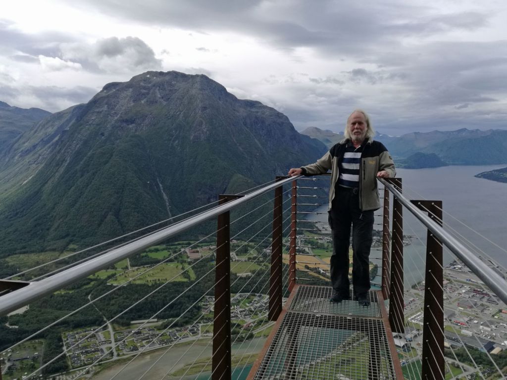
Gå til utkikk og ta et bilde av deg selv og / eller GPS-en eller andre personlige ting du hadde med deg. Bildet må tydelig vise at du er på plattformen (se eksempelet mitt). Last opp bildet i loggoppføringen. Logger uten tilsvarende bilde blir slettet!
Ha det gøy!
reindeer 

reindeer on the platform on 22.08.2019
 English
Viewpoint Rampestreken is a fantastic experience. The lookout is 537 meters above sea level, and Åndalsnes is beneath your feet.
From the start point in Åndalsnes town center the trail ascends steeply until reaching the view point, Rampestreken, 537 metres above sea level. The locals love this hike, and they often do this for exercising to be rewarded with a magnificent, breathtaking view. It’s classified as a moderate hike, however the last part is quite steep – but manageable. When you reach about 430 masl the trail steepens into stone steps, where the path is made durable thanks to wonderful pieces of stone construction works by Nepalese Sherpas. Worth a study itself, called Romsdalstrappa. The steps provide a solid path most of the way to the top. The path is well marked with signposts and red marks painted on trees and rocks. You’ll be updated with signs telling you the elevation every 100 height-meters from the goal.
Your task:
Go to the lookout and take a picture of yourself and / or your GPS or other personal item you brought with you. The picture must clearly show that you are on the platform (see my example). Upload the image in your log entry. Logs without a corresponding image will be deleted!
Have fun!
reindeer 
Virtual Rewards 2.0 - 2019/2020
This Virtual Cache is part of a limited release of Virtuals created between June 4, 2019 and June 4, 2020. Only 4,000 cache owners were given the opportunity to hide a Virtual Cache. Learn more about Virtual Rewards 2.0 on the Geocaching Blog.