Your tasks – the C.S.I. work!
At GZ you will be looking at the magnificent Grand Baie. In order to substantiate your visit and be able to claim this EarthCache a number of questions need to be answered and submitted to the cache developer, via e-mail, to “cincolcc [at] gmail.com”
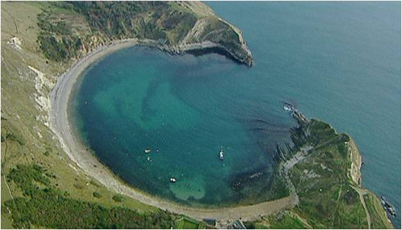
1 – In your own words explain what you understand about the formation of a bay and a headland.
2 – Look at the “entrance” to Grand Baie ahead of you – describe what the headlands look like from your position? [Are they tall, or low in structure? Are they rocky? etc]
3 – How do YOU think Grand Baie was formed? Describe in your own words.
4 – Describe how Grand Baie might differ from some of the other bays that you have seen on the island.
5 – At GZ you are standing on an object – what is it?
6 – Comment on the rocks that you passed walking to GZ. Colour, structure, origin, surface, etc.
6 – OPTIONAL – post a photo of your team at GZ.
NOTE: You may log your visit prior to approval, but e-mail submissions that do not meet the above criteria will be deleted.

What is a bay and how are bays they formed?

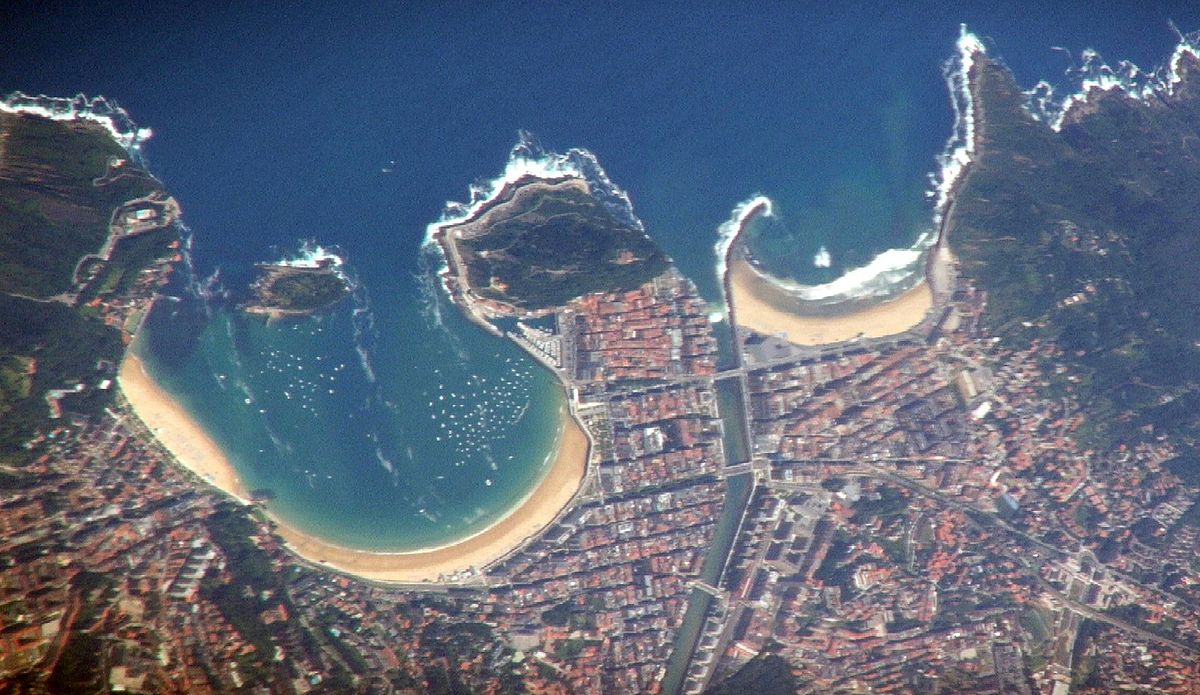
Headlands are formed when the sea attacks a section of coast with alternating bands of hard and soft rock. The bands of soft rock, such as sand and clay, erode more quickly than those of more resistant rock, such as chalk. This leaves a section of land jutting out into the sea called a headland. The areas where the soft rock has eroded away, next to the headland, are called bays.
A bay is a recessed, coastal body of water that directly connects to a larger main body of water, such as an ocean, lake, or another bay. A large bay may be called a gulf, sea, sound, or bight. [eg: Bay of Bengal, Great Australian Bight, etc] A cove is a type of smaller bay with a circular inlet and narrow entrance. A fjord is a particularly steep bay shaped by glacial activity.
Bays can be the estuary of a river, such as the Chesapeake Bay, an estuary of the Susquehanna River. Bays may also be nested within each other; for example, James Bay is an arm of Hudson Bay in north eastern Canada.
The land surrounding a bay often reduces the strength of winds and blocks waves. Bays were significant in the history of human settlement because they provided a safe place for fishing and safe anchorage. Later they were important in the development of sea trade as the safe anchorage they provide encouraged their selection as ports.
The United Nations Convention on the Law of the Sea (UNCLOS), also called the Law of the Sea defines a bay as a well-marked indentation whose penetration is in such proportion to the width of its mouth as to contain land-locked waters and constitute more than a mere curvature of the coast. An indentation shall not, however, be regarded as a bay unless its area is as large as, or larger than, that of the semi-circle whose diameter is a line drawn across the mouth of that indentation.
How are they formed?
There are various ways from which bays can be created. The very large bays have developed as a result of plate tectonics. As the super-continent Pangaea broke up along curved and indented fault lines, the continents moved apart and the world's largest bays formed. These include the Gulf of Guinea, Gulf of Mexico and the Bay of Bengal, which is the largest bay in the world.
Another way bays form is via glacial and river erosion. A bay formed by a glacier is a fjord. Rias are created by rivers and are characterised by more gradual slopes. Currents can make waves more constant, and soft rocks speed erosion. Hard rock eroded less quickly, leaving headlands. The Gulf of California is an example of a bay created by plate tectonics as Baja California peninsula moves away from the Mexican mainland.
Bays can also be called lagoons, sounds, and bights. Lagos, the capital of Nigeria, is a bayside city. It sits on Lagos Lagoon, on the Bight of Benin, in the Gulf of Guinea, in the Atlantic Ocean.
Bays form in many ways. Plate tectonics, the process of continents drifting together and rifting apart, causes the formation of many large bays.
The Bay of Bengal, the largest bay in the world, was formed by plate tectonics. Millions of years ago, the Indian subcontinent crashed—and continues to crash—into the the massive Eurasian plate network. The Indian plate is subducting beneath the small Burma plate, forming the Sundra Trench. Because plate tectonics remain an active force in the Bay of Bengal today, the region is home to underwater earthquakes and tsunamis.
Bays are also formed when the ocean overflows a coastline. Kowloon Bay, Hong Kong, was formed as the South China Sea overflowed the coastline of the Kowloon Peninsula. Today, Kowloon Bay has been almost entirely reclaimed from the sea. Kowloon Bay is a major industrial and financial area, and was home to Hong Kong's airport until a new facility was built in 1998.
Another well-known coastal bay is New York Bay. New York Bay is actually two bays (Upper New York Bay and Lower New York Bay) connected by a strait called The Narrows. New York Bay is where the Hudson River meets the Atlantic Ocean.
Many bays are formed as the coastline erodes into the ocean. Guanabara Bay, for example, was formed as the Atlantic Ocean eroded an inlet in South America. Today, Guanabara Bay, also known as the Harbour of Rio de Janerio, Brazil, is one of the Seven Natural Wonders of the World.
A type of bay known as a ria is actually an estuary that has been taken over by the ocean. (An estuary is the mouth of a river.) Rias are often called "drowned rivers." Chesapeake Bay, on the East Coast of the United States, is one of the world’s largest rias. It is the drowned mouth of the Susquehanna River.
Fjords are narrow bays formed by glaciers. A glacier slices through the bedrock of an area, leaving a long, steep canyon when it recedes. The sea seeps into the inlet, forming a fjord.
Bays can also be found along the shores of lakes. Georgian Bay, for example, is a prominent bay in Lake Huron, one of North America’s Great Lakes. Georgian Bay is located in Ontario, Canada.
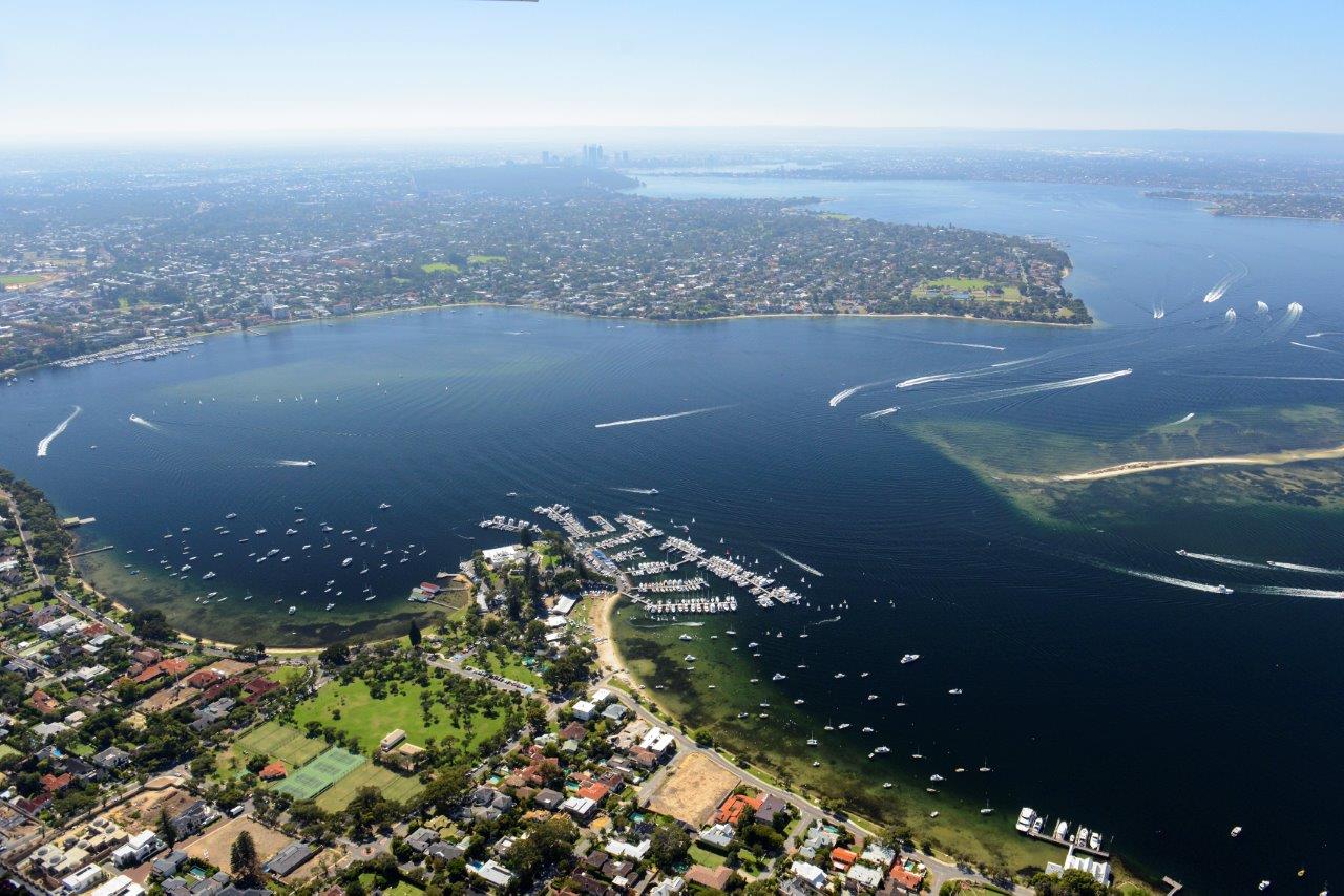
Freshwater Bay [see below] is a bay on the Swan River, near the busy urban area of Perth, Australia. Freshwater Bay has been a centre of trade and transportation along the river for centuries.
REFERENCES:
http://www.bbc.co.uk/schools/gcsebitesize/geography/coasts/erosional_landforms_rev2.shtml
https://en.wikipedia.org/wiki/Bay
https://www.nationalgeographic.org/encyclopedia/bay/