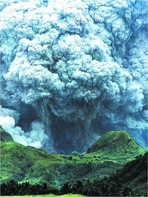
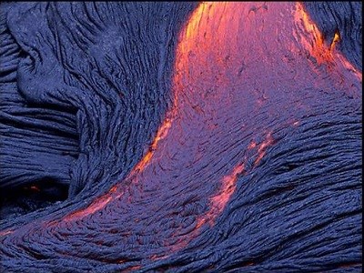
The Dry Canyon story starts around 30 million years ago. That’s when the Crooked River Volcano erupted in a series of pyroclastic explosions, (a fast-moving current of hot gas and rock, which reaches speeds moving away from a volcano of up to 450 m.p.h.) like this one.
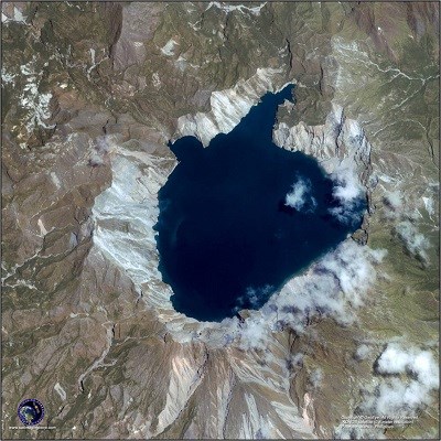 Eventually the top of the Crooked River Volcano collapsed, leaving a huge caldera (like the one on the left). It formed a semi elliptical crater, roughly 27 miles by 17 miles across. The Crooked River Volcano is the 7th largest volcano in the world. It is about ½ the size of the smaller of the two super volcanoes that created Yellowstone NP. Because many of the hills that define the ancient crater’s rim were covered by basalt flows from more recent Newberry Crater eruptions, the Crooked River Volcano was not even discovered until very recent times.
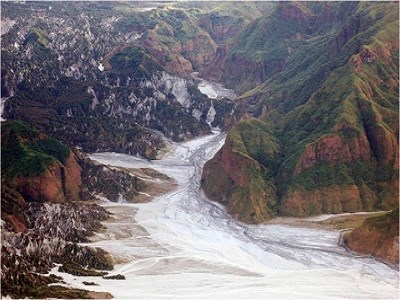
The pattern, in which the Crooked River Volcano ash eruptions were distributed, along with the erosion-depositing action of the ancient Crooked River over eons of time, caused the floor of the Crooked River Volcano to slant in a direction that influenced the orientation of newer rivers like the Deschutes. The 27x17 mile extinct volcanic crater’s high point was in its Southeast corner (SE of Prineville) and it runs downhill, towards its Northwest corner (near Lake Billy Chinook).
Fast forward to around 1 million years ago. That’s a long time for you and me, but just a short sip of water in the history of our earth’s geology.  That’s when the Newberry Volcano began erupting. Its initial activity created the large oval-shaped caldera 4 by 5 miles in diameter, called the Newberry Caldera which defines the Newberry Volcanic National Monument of our time. Within the caldera there are two lakes (Paulina Lake and East Lake), many pyroclastic cones, lava flows, and obsidian domes.
In its entirety, the Newberry Volcano is a shield volcano. This describes a broad layer of basalt rock, approximately 500 square miles of stretching from Fort Rock in the South, to Lake Billy Chinook in the north, which flowed from many Newberry Volcano vents, over thousands of years. The basalt flows emanating from the Newberry Volcano which ran north created the current bedrock in Redmond, Bend and the surrounding areas. The Newberry Volcano is still regarded as an active volcano, having erupted as recently as 1,300 years ago, and a total of at least 25 times in the past 10,000 years.
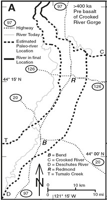
The story of the Redmond Dry Canyon
 starts about 400,000 years ago. Prior to that time, the Newberry Volcano basalt flows had left the Deschutes River flowing south to north (remember the influence of the Crooked River Volcano), in a course that took it east of both Bend and Redmond, as shown in Map A.
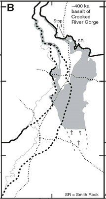
More rivers of lava poured out of the Newberry Volcano. Then, around 400,000 years ago, the Basalt of Crooked River Gorge moved part of the Deschutes River westward, so that it flowed through present day Redmond. The ancient Deschutes proceeded to run through the area now occupied by Redmond’s Dry Canyon, as shown in Map B.
For more than 300,000 years, the Deschutes River, carving and depositing as it flowed, sculpted the prototype of what we now know as the Redmond Dry Canyon. Then more oceans of lava flowed from the Newberry Volcano.
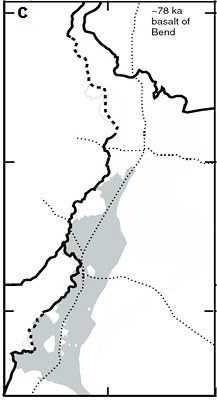
About 78,000 years ago the Basalt of Bend
 flow (Map C) moved the Deschutes further west, close to its current alignment. Phase 1 of the Redmond Dry Canyon formation process had been completed, and then the area lay dormant for a few thousand years.
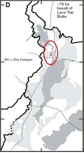
3,000 years later, part of the Lava Top Butte basalt reached the area just south of Redmond. As its force decreased, the flow took the course of least resistance. Following gravity, it flowed down the Redmond Dry Canyon, paving the bottom and sides of the Dry Canyon with basalt rock, completing Phase II of the canyon formation (notice the skinny ribbon of lava flow, labeled DC in Map D below). The flow continued northward, ending as it spread out in the area occupied now by Lake Billy Chinook. Closer to the bottom of the map, you see that this basalt also moved the river west of Bend.
In summary, the Redmond Dry Canyon was created by the sculpting powers of the ancient Deschutes River that flowed through it for 300,000 years.
Requirements: To log this cache, message me with the answers to the following questions. Do not post answers in your log. You may log this cache as found when you submit your answers. If you have any answers with major errors I will get back to you.
1. From where is the water in the Dry Canyon believed to have originated prior to the basalt flows?
2. What is the “Rimrock” basalt that makes up the canyon rim composed of?
3. Why do you think the canyon floor is relatively flat instead of irregular in depth with boulders and rocks as most dry riverbeds are?
4. About how many years ago did the Deschutes River move close to its current alignment?
5. (Required) Post a selfie picture with the feature of Dry Canyon that you consider interesting or of some value to your visit. If you prefer not to have a selfie, hold your hand with a "V" for victory sign in the corner of the picture.
6. If you have time to log this Earthcache as a find, you also have time to send a message with the correct answers. If you are caching with others, the answers may be sent in for the entire group by just one of you. Just be sure to name all of the cachers involved. If after 7 days I haven't received a message with the correct answers to the four questions I will delete your find.
This Earthcache is placed with the permission of:
Annie McVay
Department of Public Works
Parks and Administration Division Manager
Redmond, OR