As with any earthcache, there is no container to be found at the posted coordinates.
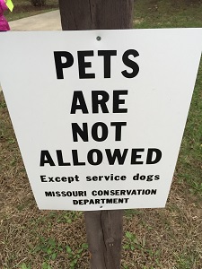
Stay on trails and follow all rules and posted signs
Thanks to the Cape Girardeau Conservation Center for permission for this earthcache.
This earthcache and the park are only available from sunrise to 10:00PM.
Stay within the park and do not enter people’s property that surrounds this park.
M.D.C. is not liable for your safety.
Do not enter the sinkhole area.
and do not leave the trails
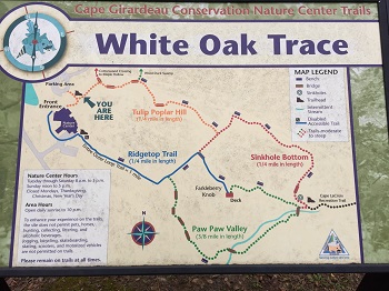
For a trail map click this image:
Karst Topography
Karst topography is a geological formation shaped by the dissolution of a layer or layers of soluble bedrock, usually carbonate rock such as limestone or dolomite. Karst landscape, which occurs in many parts of Eastern Tennessee, has springs, sinking streams, caves, and sinkholes. The karst terrains of Tennessee are mostly on limestone and formed over hundreds of thousands of years. As water moves underground, from hilltops toward a stream through tiny fractures in the limestone bedrock, the rock is slowly dissolved away by weak acids found naturally in rain and soil water.

Source: Link
Missouri is known as the cave state with new caves being recorded every year. As of 2013 there are over 7,500 recorded caves in Missouri, with the vast majority of them in the Ozark region of Missouri. There are more caves in Missouri then in any other state.
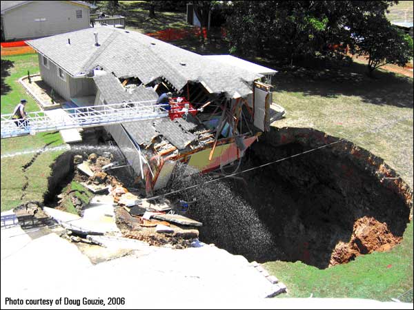
Sinkhole
A sinkhole. It is a natural depression in the Earth's surface caused by erosion. Water seeps into cracks in the bedrock and erodes away at it. Over time the cracks get bigger and bigger and soon a cave is formed. Size of the cave below is not important, just know that its down there. A sinkhole starts to become visible when the ground starts to sink lower than the surrounding ground. Sometimes this can happen in an instant and sometimes this can happen slowly over a long period of time.

Source: Link
Solution Sinkhole
Solution sinkholes occur in areas where limestone is exposed at land surface or is covered by thin layers of soil and permeable sand. This type of sinkhole usually forms as a bowl-shaped depression with the slope of its sides determined by the rate of subsidence relative to the rate of erosion of the walls of the depression from surface runoff.

Source: Link
Collapsed sinkhole
collapse sinkholes occur where a solution cavity develops in the limestone to a size such that the overlying cover material can no longer support its own weight.
Source: Link
**Logging requirements**
DO NOT POST ANSWERS IN YOUR LOG.
Send the following answers to me via email.
- The text "GC68HTE Karst Topography ~ Nature center" on the first line
- Are these a “Solution sinkhole” or a “Collapsed sinkhole”?
- While standing along the fence, count the number of sinkholes within the area
- What is the main reason why this sinkhole would grow?