Thark Hut was built in 1901 for use during the survey of watersheds of the streams west and south of Collins Bonnet. In the 1920s it was used as a ski camp by members of the Ski Club of Tasmania. Existence was kept secret.
The hut Built of sawn palings with a galvanised iron roof, wooden floor and with a large stone fireplace at east end. Photos show the hut was in good condition in 1966. The photos show the hut to be a vertical timber plank clad, gable roofed hut. It was named Thark Hut in the 1930s, which may seem a strange name and some reports suggest that a theatrical play that was on in Hobart at the time inspired the name. It was vandalised in 1966 and burnt down in the 1967 bushfires.
If you went back some 20 years or so there was no track on Thark Ridge and even the pad along the flank was pretty minimal; however since then it has received more usage, and markings and pruning of vegetation gradually made an impact on the area. The start of track in particular became a degraded affair with multiple pads over the wet plain and then further along an unsightly section of with destroyed pineapple grass that turned to a bog. The Wellington Park Bushcare Group has rerouted and repaired the track over the last couple of years.
There are still a few signs of hut out there.
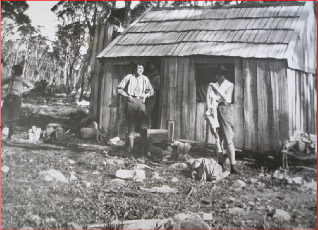
Photo by Jack Thwaites of Thark Hut
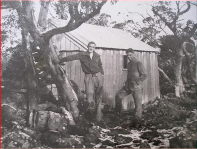
Photo of Thark Hut by Jack Thwaites collection - Jack Thwaites on left Alf White on right
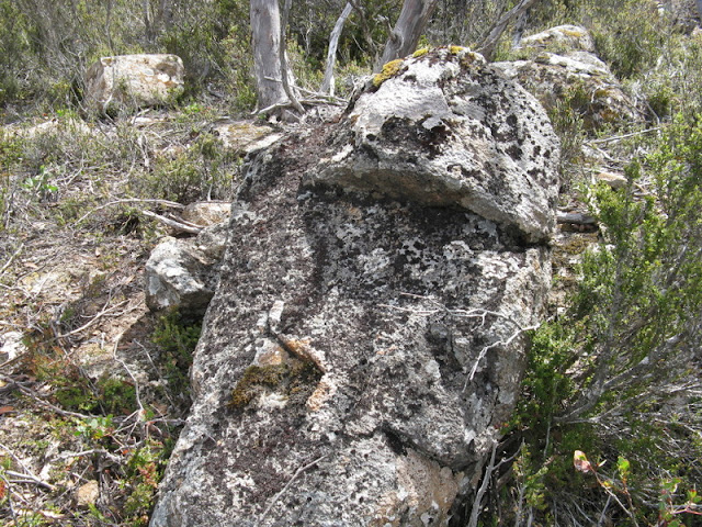
If you see this rock you are at GZ