Let’s follow LPT 1
McKee Clan’s cache
Let’s follow LPT (Little Para Trail) is a series of
caches along the trail for you to find. Please enjoy the walk as we
have and happy hunting.
Due to the number of caches in Carisbrook park and Howie bowie
reserve we decided to start here and continue out to sea. Enjoy the
walk or ride.
FTF
TiedyeSmileys STF Team Janson TTF DennisC52
Please follow the: 
Local point of interest
At this point-
There
is what we think is an old well. When trying to research this spot
we came up with nothing but we found that there were some wells
along the trails used for the farms that used to be here many years
ago. If anyone knows any more information about this spot we would
love to know.
Pioneer Park -
The Water Wheel museum is the focal point of this
area. A project undertaken
by the Rotary Club of Salisbury the Water Wheel
was recovered from the Old Spot Hotel and restored to original
condition. LPT 2 has more information on the wheel
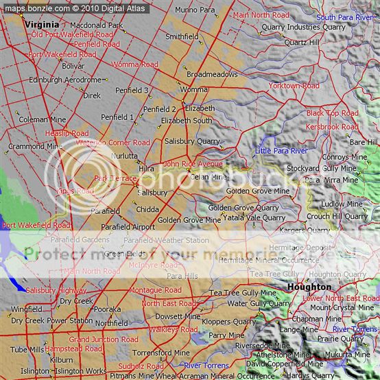
Little Para
Trail
The Little Para Trails
follow the Little Para River, which has many attractions for all to
enjoy. Flowing from the City of Salisbury's hilly escarpments to
the plains, it meanders through many significant sites that played
an important role in the early development of the City. Of great
importance are the remnants of natural landscapes present along the
river's edge. Varieties of eucalyptus woodland and native golden
wattle still exist and some of the earliest almond trees and orange
groves are still blossoming.
Points of interest along
the trails include Deal Court, Paralowie House, Pitman Park, the
Old Water Wheel, Harry Bowey Reserve, and Carisbrooke
House.
Little Para
River
Origin
– near Lower Hermitage
Mouth
– Globe Derby Park
Avg
Discharge – 3590 m6/year
The
Little Para River is a seasonal creek running
across the Adelaide plains
of South
Australia, whose catchment fills reservoirs that supply
some of the water needs of Adelaide’s northern suburbs. It
runs from its source near Lower Hermitage
in the Mount Lofty
Ranges, flows north westerly to the Little Para
Reservoir and then westerly to the Barker Inlet of
the Gulf St Vincent
at Globe Derby Park. The lower portion of the river is badly
affected by human activity and storm water
runoff but the upper reaches have a good range of biodiversity.
The river
attracted John Harvey to form his settlement at Salisbury in
1847 and was crucial to the development of the citrus industry
from 1852. In the 1960s the City of
Salisbury began acquiring land for public space, and a
belt of parklands with
biking and walking trails now borders the river. The river’s
name derives from the Kaurna word
Pari which roughly translates as a stream of flowing
water.
As the
river flows down from the Adelaide Hills over the Para fault escarpment, it
has formed a large alluvial fan on
which Salisbury is built. The river is narrow and winding, formerly
flooded in heavy rain and rarely reaches its sea outlet. Over time
the river has been widened and levees added to
reduce this flooding. In the 1800s lack of consistent flow in the
river and the absence of an organised water supply
system led to the digging of wells. The Little Para
refreshes the well's water, mostly held in clay, sand and gravel
layers up to 200 feet (61 m) deep. The Little Para
Reservoir is built in the path of the river for water
storage and flood mitigation. As the river's catchment is
insufficient to fill the reservoir, it is mainly used to store
water pumped from the River Murray.
Periodically water is released from the reservoir into the river,
enabling refreshing of ground
water.
From
Wikipedia, the free encyclopedia
Little
Para river is marked in yellow with blue tributaries
|
|
|

|
Populated
Areas
|

|
Sand
|
|

|
Reserves and
Parks
|

|
Native
Vegetation
|
|

For the
First to find there is a certificate and a unique FTF path tag.
They are not swapped or given out so the first to find pathtag will
be a unique item that no one else will have. We will contact the
FTF to send the prize. Good luck