

As we understand ecological processes better, we see that wetlands are, in fact, valuable natural resources. Wetlands help to regulate water levels, improve water quality, reduce flood and storm damage, control erosion and sedimentation, and provide habitat for a multitude of plant and animal species. An estimated 5,000 plants, 190 amphibians and reptiles, 1/3 of all birds, and 35% of all threatened and endangered species depend on wetlands for their survival. Restoring our lost and degraded wetlands to their natural state is essential to ensure the health of America’s watersheds. Listed below are a few wetland areas that one might encounter in Wisconsin.
Swamps:
Swamps, also known as muskegs, are forested wetlands often found near rivers, streams or lakes. They generally have a substantial number of dry-land protrusions (called hummocks) which are composed of thick, acidic, nutrient-rich black soils formed from decaying plant matter. These slow draining soils create the perfect environment for the growth of water-tolerant woody plants and trees such as cedars, hemlocks, pines, spruces, maples and cottonwoods. In the transition of a wet meadow becoming a “true” forested swamp, one will find a shrub swamp. Shrub swamps are dominated by small shrubs and trees such as buttonbush, willows, dogwoods, elderberries, swamp rose, foxtail, swamp milkweed and false nettle
Marshes:
A marsh, sometimes called a morass, is a type of wetland temporarily or permanently covered with shallow slow-moving water. Their water supply comes from adjacent rivers, streams or lakes (surface water). They are predominately covered by “soft-stemmed” vegetation that has adapted to saturated soil conditions. They are generally treeless and open. Hydrophytic vegetation (aquatic plants) found in marshes around Wisconsin, include sedges, cattails, bulrushes, giant reed, typhas, arrowheads and spike rush. Nutrients within these waters are plentiful and the pH level is usually neutral. Marshes are incredibly diverse places, playing host to large populations of migrating birds, amphibians, fish and aquatic insects.

Bogs:
A bog, also called a mire, is characterized by spongy peat deposits and a floor covered by sedges and sphagnum mosses. Bogs receive most, if not all, of their water from precipitation (ombrotrophic). Being rain-fed, nutrients needed for plant growth, are low or non-existent. Plant life, strong enough to survive these conditions includes cotton grasses, cranberries, bog rosemary, sheep laurel, leatherleafs and pines. Animal life within a bog can include turtles, frogs, insects, and birds, with a limited number of fish species adapted to survival within these oxygen depleted waters.
Fens:
Fens are peat-forming wetlands that receive nutrients from moving surface or groundwater, and not from precipitation. These nutrient rich waters promote the growth of bog birch, shrubby wildflowers, willows, grasses, sedges and rushes. Water chemistry, within these fens can be either neutral or alkaline, as opposed to that of a bog, which is acidic. Over time, peat build up can separate fens from their water supply, cutting off their essential nutrients, altering it into a bog. Bogs and fens are generally found in the northern hemisphere, occurring in the northeastern United States, the Great Lakes region and much of Canada. They generally occur when low temperatures, short growing seasons and high humidity comes together allowing excessive moisture to accumulate.
Bonus Site #1: Accidental Arsenic Spill
The Wisconsin Department of Natural Resources was informed that a small area within this wetland was completely devoid of plant life, and in a larger surrounding area, plant life was severely distressed for an unknown reason. The WDNR and the former property owner joined forces in an investigation to determine the cause, degree and extent of this problem. Together they collected soil and water samples from the area and found high concentrations of arsenic. These high concentrations were thought to have come from a train derailment and subsequent spill of Sodium arsenate some years prior. During that time period, sodium arsenate was a commonly sprayed insecticide used on Door County fruit trees. The results of the initial investigation found that approximately 15 acres contained elevated levels of arsenic, with the highest levels being within the dead and stressed area of vegetation.
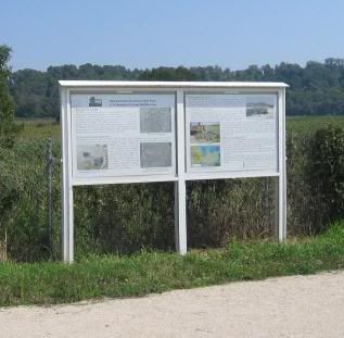
Arsenic Information sign
N44 28.544 W87 31.052
A Temporary Fix:
A cover “or Cap” was installed over the area to limit contact by humans birds and animals. The cap was constructed from large sheets of Styrofoam placed on the land surface and covered with a geotextile fabric. This fabric was then used to support a layer of wood chips and a dense vegetative mat. This cap was “not” intended as a long-term solution and will quickly degrade, exposing the arsenic contaminated soil once again. This was an interim measure put into place until a more feasible and permanent solution could be implemented at this site.
Bonus Site #2: Wetlands Walk
Located just 1,000 feet away from the parking coordinates, at N44 27.996 W87 30.118 is a 1,500 ft. boardwalk path leading into the middle of this wetland. This is also a good place to find parking. This area is well known to be a birders' paradise, where a wide variety of waterfowl congregate. The walkway meanders through the wetland habitat, with benches along the way, ending in an observation deck with a breathtaking panoramic view.
Logging Requirements:
As you hike/bike/ski to the coordinates listed, observe both sides of the trail. Each side of the trail is home to a different type of wetland. To the south-southwest side (on your left) the wetland type is fairly obvious. To the north-northeast side (on your right) the wetland type is less defined, but can be found in the descriptions above. Along your hike you will also pass a trail sign with an animal listed on it.
Email your answers to the questions, to me, using the link in my profile only. If your answers are not recieved by me, your log will be deleted. Photos are accepted and appreciated as long as the answers are not pictured. You do not have to wait for confirmation from me before logging this cache as completed. Most of all……learn……and enjoy the view.
N44 28.151 W87 30.110 parking and trail head
1. What type of wetland is found on your left as you walk to the coordinates? Select one of the 4 types described above.
2. What type of wetland is found on your right as you walk to the coordinates? Select one of the 4 types described above.
3. What is the source of the water feeding this wetland?
Answer one (1) of the three (3) questions listed below.
4. What is the elevation above sea level at the coordinates?
5. What is the temperature of the water?
6. What is the pH level of the water?

