Black Rocks Earthcache at Presque Isle EarthCache
Black Rocks Earthcache at Presque Isle
-
Difficulty:
-

-
Terrain:
-

Size:  (not chosen)
Please note Use of geocaching.com services is subject to the terms and conditions
in our disclaimer.

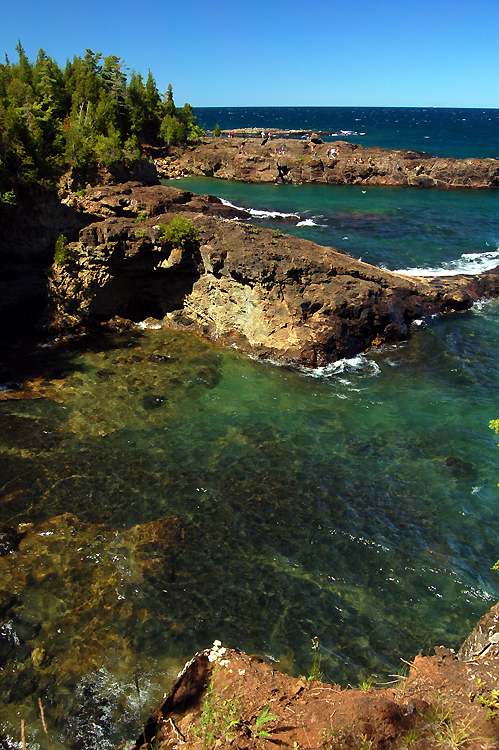
The cache coordinates will take you to the center of the Black
Rocks volcanic formation on Presque Isle. The road to Presque Isle
will remain open until 11:00 pm nightly. Restricted hours for
walkers are:
Sat & Sun 7 am - 10 am, Mon & Wed 6 pm - 8 pm, Tue &
Thu 7 am - 1 pm.

Presque Isle is a small peninsula of 233 acres that sticks out into
Lake Superior on Marquette’s north side. The park has a jagged
shoreline that is more than two miles in length and contains some
of the oldest exposed rock formations in North America. The east
side of the peninsula features sandstone cliffs nearly 100 feet
high, small caves, and crystal clear water. Please take time to
walk the many trails in the park as there are several geocaches in
the area. The coordinates will take you to some black lava type
Pre-Cambrian rocks that are over 1 billion years old.
Geologically Speaking: This outcrop is thought to be an Archean
peridotite. It is highly deformed and may represent a fragment of
the deeper Archean oceanic crust. The veins that run throughout are
composed of carbonates. In the low cliff above the peridotite, one
can see the basal members of the Jacobsville Sandstone. At the base
of the sandstone is a Mesoproterozoic paleosol. Um, OK - what does
that mean? In a nutshell, the rocks you are standing on are from
the Earth's mantle and are exactly what you would expect to have
found at the bottom of the ocean about a billion years ago.
Now a little bit about the rock itself: Peridotite is a dense,
coarse-grained igneous rock, consisting mostly of the minerals
olivine and pyroxene. Peridotite is ultramafic and ultrabasic, as
the rock contains less than 45% silica. It is high in magnesium,
reflecting the high proportions of magnesium-rich olivine, with
appreciable iron. Peridotite is derived from the Earth's mantle,
either as solid blocks and fragments, or as crystals accumulated
from magmas that formed in the mantle. Now that you know a little
more about the rocks you came to visit, let's talk about
safety!
These formations are very dangerous during storms when the surf is
high, so use common sense and don’t attempt if the rocks are
slippery or the waves threaten to pull you into the lake. (Yes,
it's happened.)
To get the SMILEY --> Requirements for
logging this earthcache: First, go to N46 35.573, W087 22.806 and
take an altimeter reading with your GPSr. Notice the clarity of the
water (unless it’s frozen!). Next, go to N46 35.562, W087 22.823
and take another altimeter reading. Feel free to examine the cliffs
or go wading here. Subtract one reading from the other and email
the difference to the cache owners. Finally, take a picture of
yourself or your group with your GPSr in the area and post it with
your log.
Enjoy your visit to Presque Isle’s Black Rocks!
Additional Hints
(No hints available.)