Floating out on the Fen EarthCache
-
Difficulty:
-

-
Terrain:
-
Size:  (other)
Please note Use of geocaching.com services is subject to the terms and conditions
in our disclaimer.
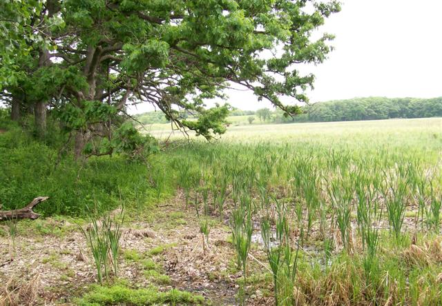
Welcome to Pike Marsh! This fen is part of the Kettle Moraine
Nature Preserve found within Moraine Hills State Park.
Because this is an Illinois State Nature Preserve you must remain
on the path and the boardwalk and do not pick or disturb any of the
plants or animals you find. More information about Illinois Nature
Preserves including the rules and regulations can be found here
Illinois Nature
Preserves.
To log this cache you will need a measuring tape and a camera.
Please keep the tape measure on the path and the boardwalk itself
as to not disturb the flora and fauna.
What is a fen? A fen is a wetland that gets most of its moisture
from an underground source that contains rocks rich in either
calcium or magnesium carbonate. As the water migrates through the
aquifer it reacts with these rocks changing the pH from neutral to
slightly alkaline. This alkaline water combined with organic matter
that is not allowed to fully decay produces an environment
conducive to alkaline loving plants such as Joe Pye weed and Kalm's
lobelia.
Glaciers can carry material for many of hundreds of miles, but most
of the material that the glacier contains was picked up from areas
directly north and east of McHenry County. Below Kenosha County
Wisconsin and Lake County Illinois is found the bedrock that is the
most common in the glacial debris in this area.
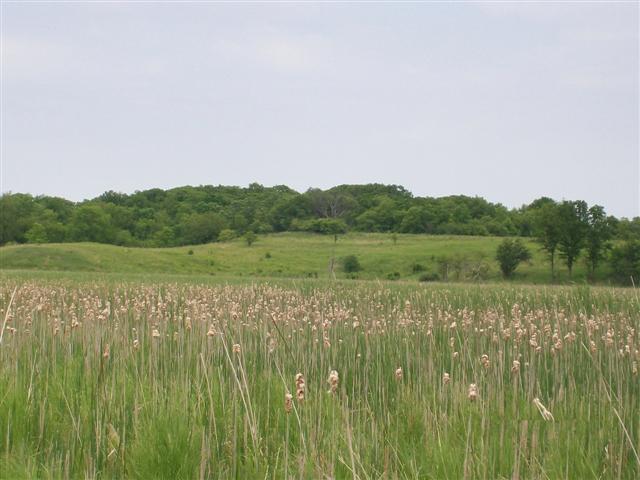
As you leave the trail and approach the boardwalk you will see a
sign. Pay attention to the different zones of the fen listed on the
sign and look for each of the different zones as you walk down the
boardwalk.
As you stand out on the boardwalk looking at the marsh you can see
the hills surrounding loom up on all sides. You can then imagine
water oozing out of the ground to feed this wetland.
Please park at the Pike Marsh Day Use area and follow the trail to
the east of the parking area. The trailhead coordinates are 42°
18.632’ N 088° 13.575’ W.
To log this cache you will need to provide the following:
1) Email ClickChik the name of the rock that reacts with the water
creating the alkaline conditions found in Pike Marsh.
2) Email ClickChik estimates of the width of the following zones in
Pike Marsh: Mesic woodland, fen, sedge meadow. Please keep the
measuring tape on the boardwalk itself as to not disturb the flora
and fauna. Please measure along the path from the sign at 42°
18.686’ N 088° 13.542’ W. Follow the curve of the
gravel path.
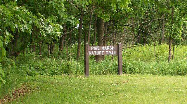
3) OPTIONAL Post a picture of you with the sign found at the
coordinates given for the cache. This is not the sign found in
#2
Do not post 1 or 2 in your log! Please remember to email them to
Clickchik.
More information about this and other Earthcaches can be found at
www.earthcache.org
Please keep your pets and small children on the path and out of the
water. I often have students ask how deep the water is. The water
itself is not deep, but there is layers of ooze that go down for
many feet. A stroller or bike will be hard to get down and back up
the hill from the designated parking area. There is closer parking
without the walk down the hill, but it requires you to cross the
road at a place where it can be dangerous because of blind
curves.
Additional Hints
(Decrypt)
1) Gur ebpx lbh frrx vf gur fnzr nf hfrq sbe gur ovg bs teniry ba gur cngu sebz gur fvta gb gur obneqjnyx.
2) Ab arrq gb qvc lbhe zrnfhevat gncr vagb gur znefu vgfrys, lbh ner zrnfhevat ubj jvqr gur mbarf ner, abg gur guvpxarff bs gur zhpx!